Lake Karum is a salt lake located in Ethiopia, at the northern end of the Great Rift Valley. This lake, as well as the volcanoes of Dallol and Erta Ale, are among the most improbable landscapes of the Danakil Depression. This place also offers a timeless spectacle. Indeed, perpetuating a centuries-old tradition, Tigrayans travel to Lake Karum from the Ethiopian highlands, followed by long caravans of dromedaries and donkeys in order to recover salt slabs from the dry areas of the lake, a vestige of a time when the sea still flooded the Danakil Depression.
Location of Lake Karum and the Erta Ale and Dallol volcanoes
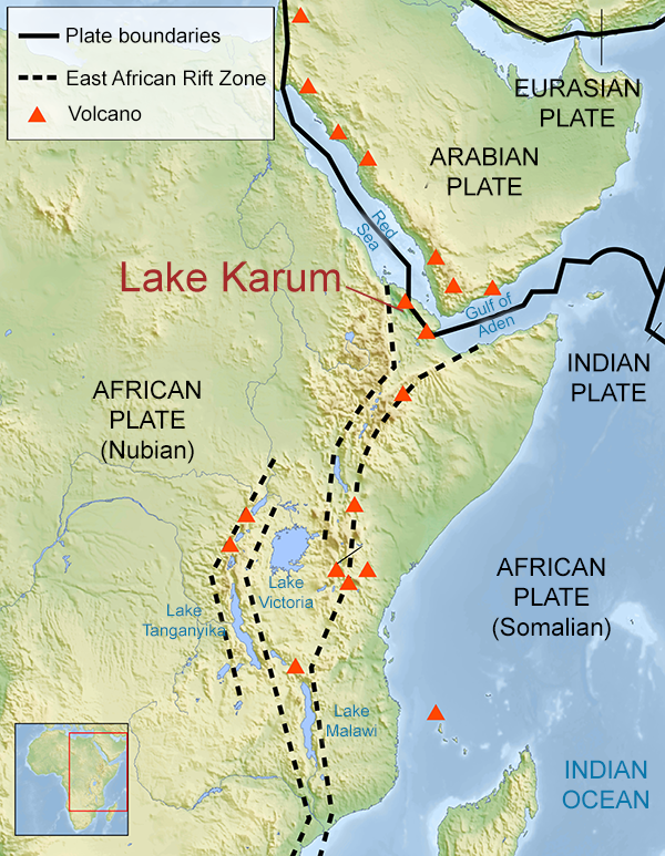
The Great African Rift Valley
A classic landscape of the Danakil Depression.
It is one of the hottest places on the planet; the mercury can climb up to 58°C.

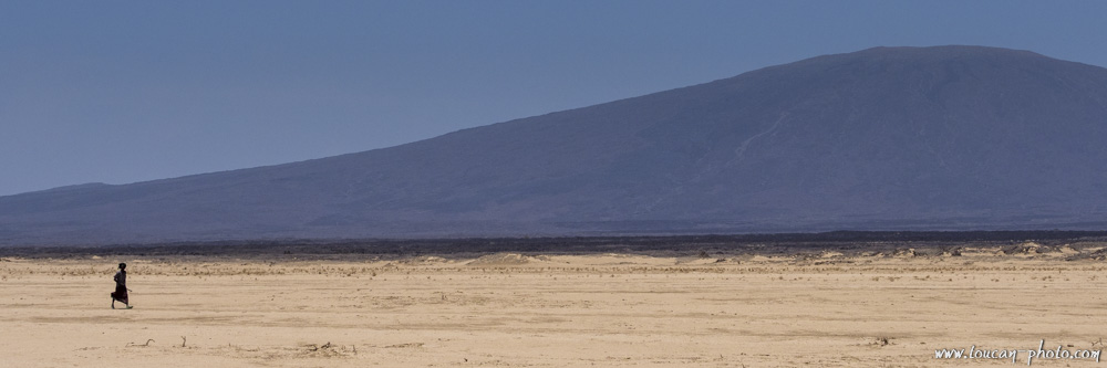
Another landscape not far from Lake Karum. Here, rainfall does not exceed 20 or 30 cm per year.
This depression is at an altitude of 120 meters BELOW sea level. A rampart of rock prevents the water of the Red Sea from swallowing up the Danakil. However, it happened several times throughout history that this rampart topology changed due to moving tectonic plates and volcanic activity in the region, allowing the waters from the Red Sea to penetrate and completely flood the Danakil Depression. This phenomenon last occurred about 30,000 years ago. Following this, the Danakil found itself again isolated from the Red Sea. The water present in the Danakil Depression then slowly evaporated, leaving a layer of salt that can reach up to 2,000 meters thick in some places.
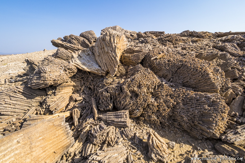
These marine coral skeletons found in the Danakil bear witness to the last flooding of the depression by the Red Sea, which occurred 30,000 years ago.
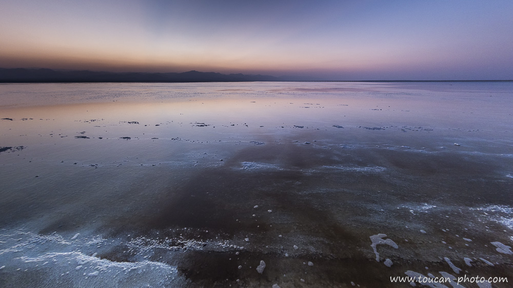
When it rains on the Danakil, the water follows the slope of the reliefs and flows to Lake Karum. In this photo, the lake is covered with a thin layer of water.
The evaporation of water creates strange shapes made of salt.
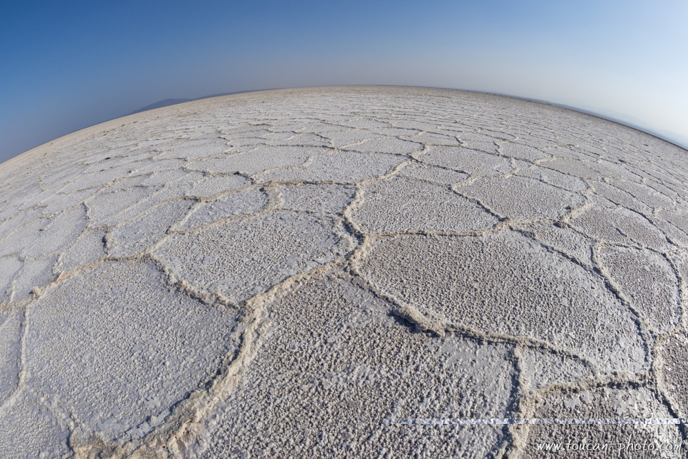
Lake Karum then becomes a salt plain, with an area of about 50 km² (18km long by 5km wide). Under the rays of the sun, the light reflected by this expansion becomes blinding.
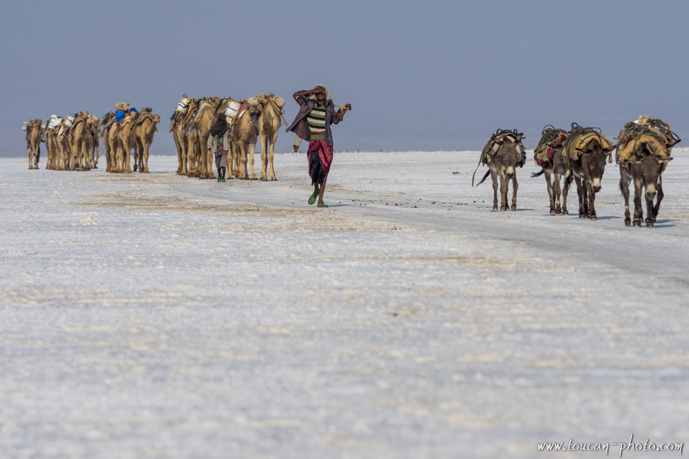
For millennia, Tigrayans have traveled to Lake Karum from the Ethiopian highlands, located more than 100km away. They are followed by long caravans of camels and donkeys. It takes between 2 and 3 days of walking for the Tigrayans to reach Lake Karum.
A camel caravan arriving at Lake Karum.
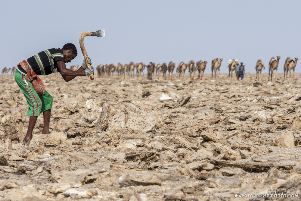
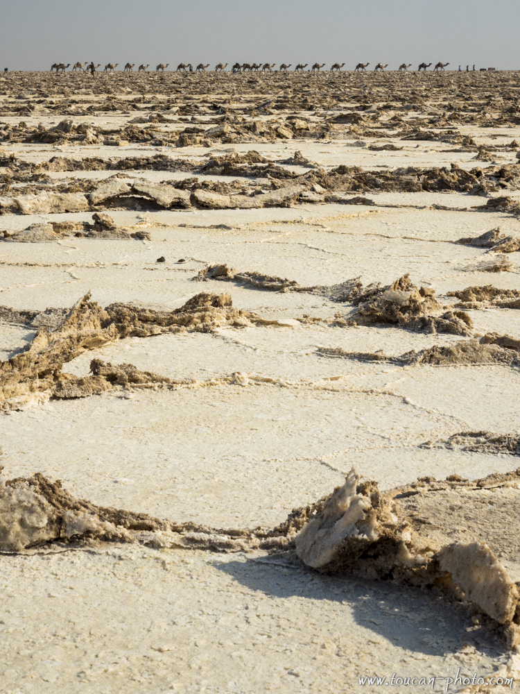
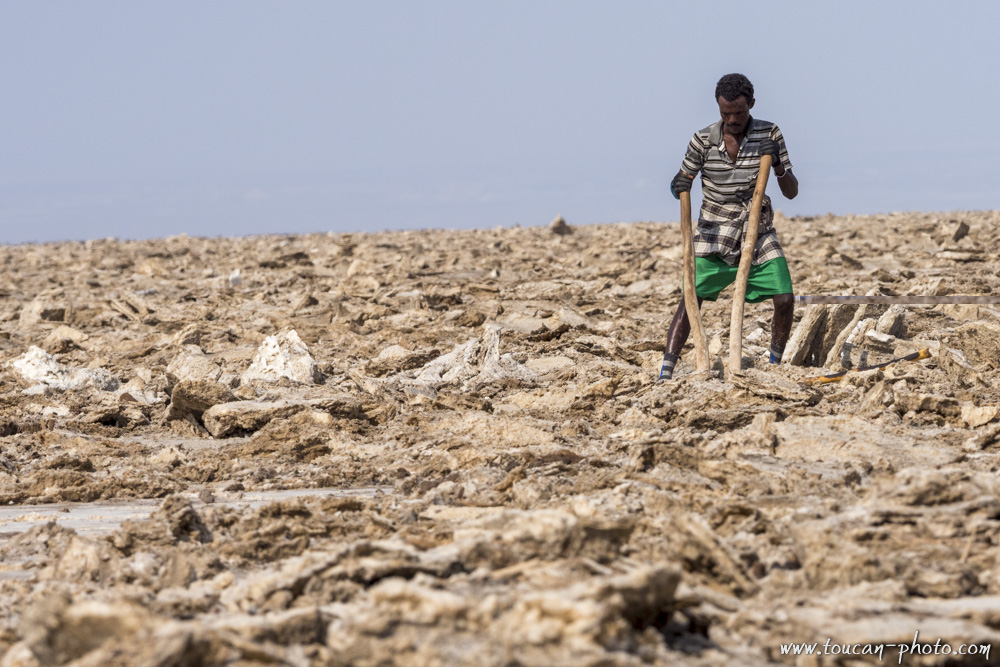
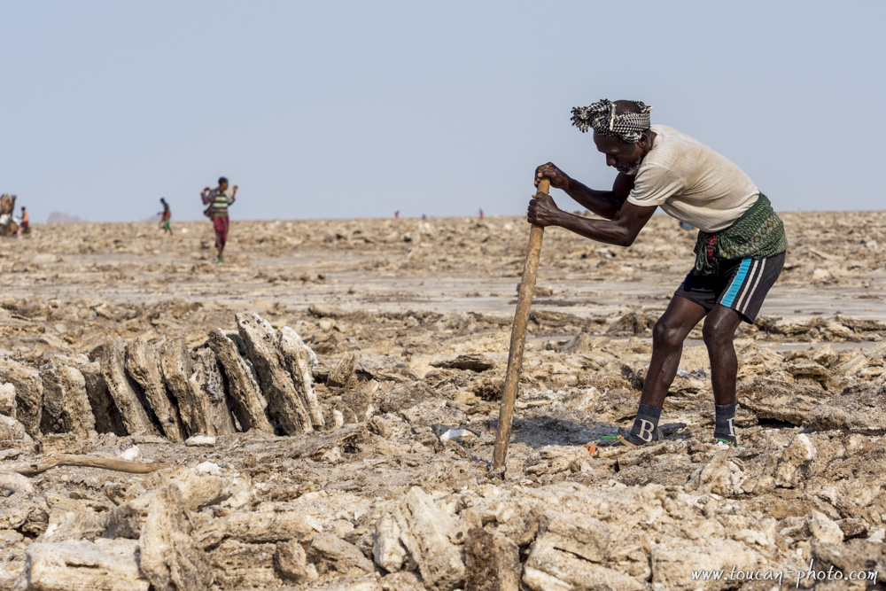
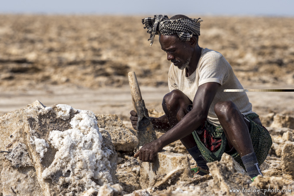
The extraction of salt is only done in the morning.
As temperatures become oppressive in the afternoon, it becomes impossible to work. To extract the salt, slabs are cut with axes. These slabs are then lifted using wooden levers.
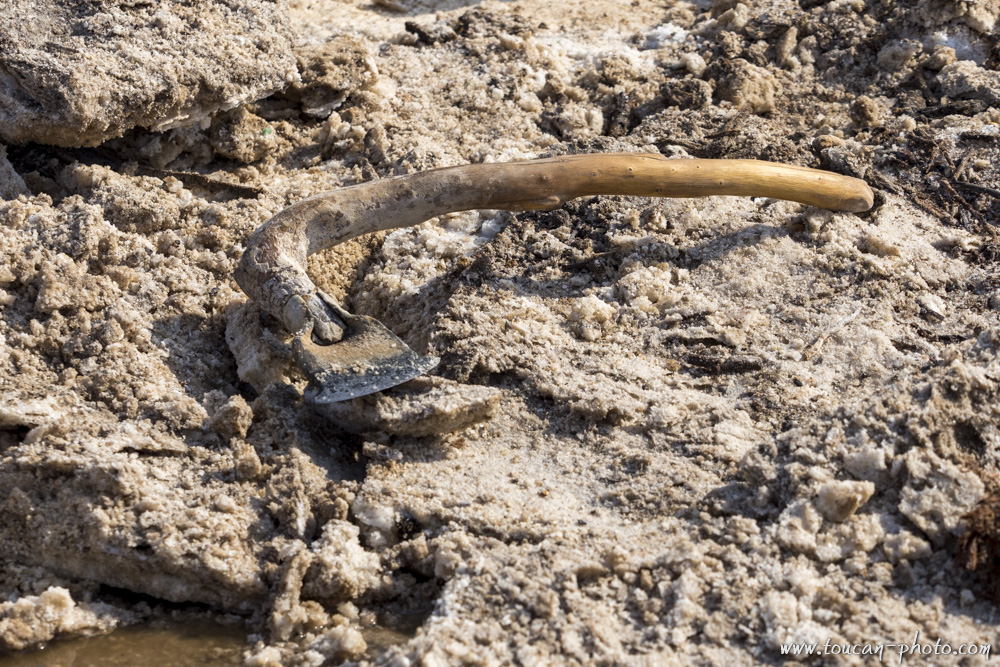
An axe used for cutting salt slabs.
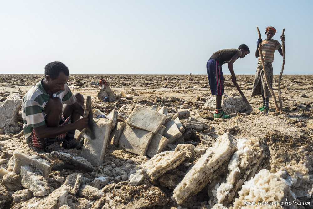
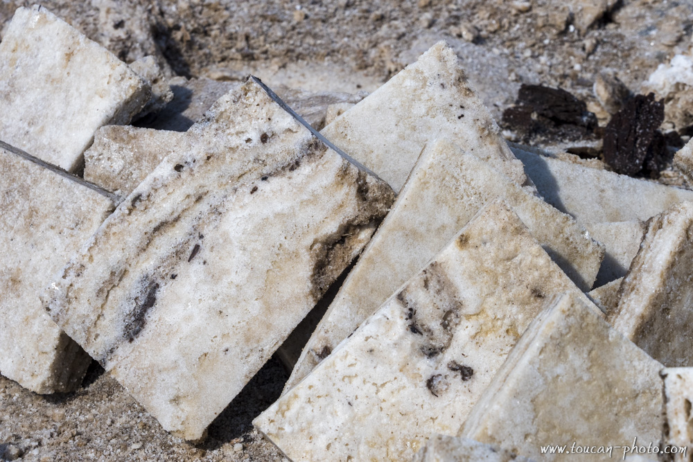
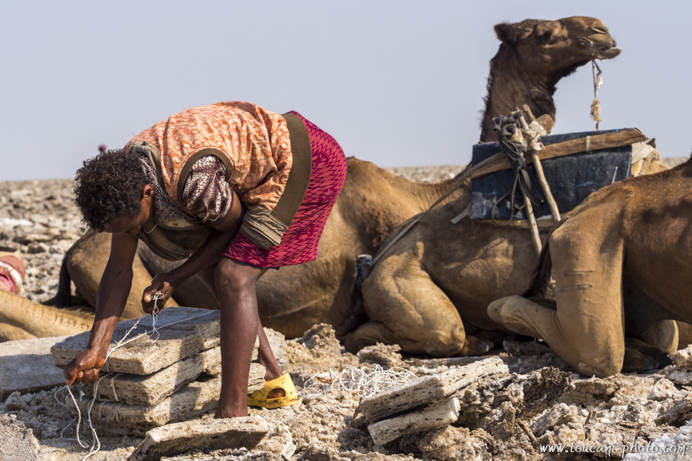
The extracted slabs are then re-cut and straightened into smaller tiles called amoles.
Each amole weighs between 5 and 8 kg.
Cutting an amole tile.
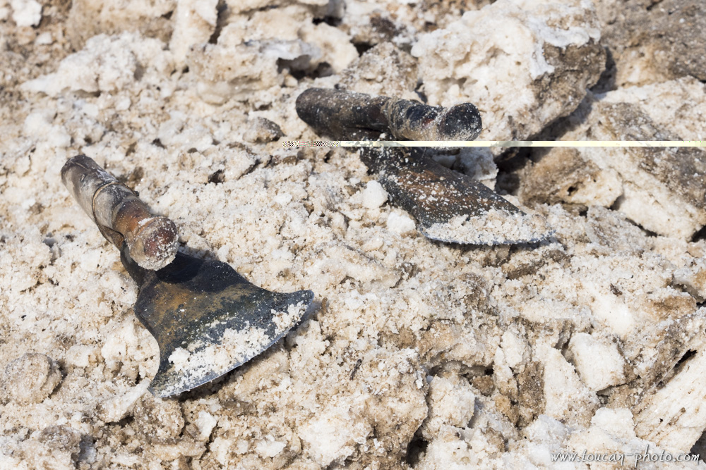
The cutting of the amoles is done using adzes.
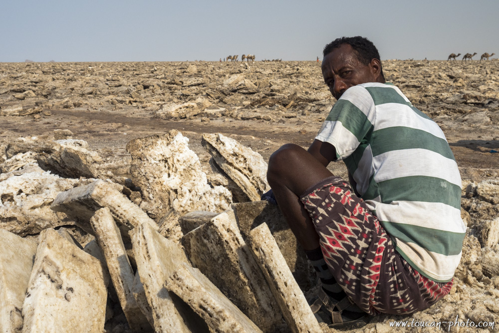
The salt harvested from Lake Karum will be used mainly for livestock feed.
The camel herders load the precious cargo onto the camels. During the return trip to the Tigray plateau, each dromedary will be loaded with a hundred kilos of salt.
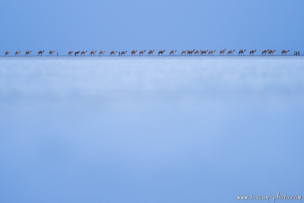
A caravan leaves Lake Karum and takes the direction of Mekele, located in the Tigray region.
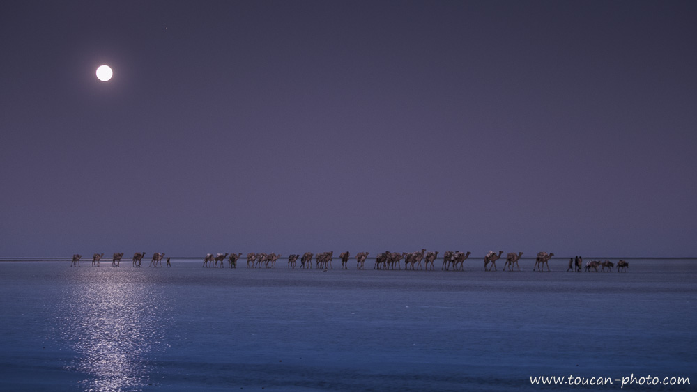
Taking advantage of the mild evening and the moonlight, a last caravan leaves Lake Karum with its load of salt.
— Continue the journey —
The Erta Ale ethiopian volcano and its lava lake
The ethiopian Simien mountain range
— Learn more —