Snow monkeys (in Japanese, nihonzaru 日本猿), also known as Japanese macaques (Macaca fuscata), are the only species of primate living in the wild in Japan. This species is also endemic to the Japanese archipelago. These monkeys are mainly found in mountainous regions, at altitudes ranging from 500 to 2,500 meters. In winter, when temperatures become harsh, these monkeys have developed a surprising habit: soaking in natural hot springs to keep warm!
Category: Paper
Ethiopia: The salt from lake Karum
Lake Karum is a salt lake located in Ethiopia, at the northern end of the Great Rift Valley. This lake, as well as the volcanoes of Dallol and Erta Alé are among the most improbable landscapes of the Danakil depression. This place also offers a timeless spectacle. Indeed, perpetuating a centuries-old tradition, Tigrayans travel to Lake Karum from the Ethiopian highlands, followed by long caravans of dromedaries and donkeys in order to recover salt slabs from the dry areas of the lake, a vestige of a time when the sea still flooded the Danakil depression.
Algeria: The Tadrart Rouge, a window to the Sahara and its history
Larger than Australia with its 8 million square kilometres, the Sahara has not always been the biggest hot desert on the planet. About 15,000 years ago, it was a green period brought about by a warming phase that had intensified evaporations from the top of the ocean and pushed the monsoons into the heart of the North African continent. The arid landscapes that we know today were then covered by large lakes and rich vegetation. Elephants were living there, as well as hippos, crocodiles and humans too. Those ones, as to immortalize this full of life period, have drawn paintings and engravings cut out of rock. These testimonies of the past are omnipresent in Tadrart Rouge. Indeed, this Sahara’s fragment is located in south-eastern Algeria and offers the vision of over 15,000 engravings to the brave who dare adventuring themselves into there. Over the sand dunes and rocky peaks, the traveller will discovers, in the same time as breathtaking landscapes, a touching testimony of the past.
Continue reading“Algeria: The Tadrart Rouge, a window to the Sahara and its history”
Russia: The Baïkal lake during winter, frozen pearl of Siberia
Under the Siberian’s winter freezing temperatures, Baïkal lake’s surface is changing into ice several months a year, usually from beginning of January to May. The 1 to 2 meters thick ice, allows people and even cars circulation on it.
The following photos have been taken during a frozen lake’s foot crossing. Several aspects of the ice, sun ray’s reverberation on it, the lights playing through the “Toros” are as many photogenic subjects that would make this crossing unforgettable.
Continue reading“Russia: The Baïkal lake during winter, frozen pearl of Siberia”
Palau: Snorkeling in the Jellyfish Lake
The Palau archipelago is located in West Pacific Ocean, east of Philippines. The archipelago is composed of more than 250 islands. Those islands are for most of them inhabited and they are mainly covered with tropical forest and mangrove. This short presentation is by itself forewarning nice adventures. But adding to that a lake full of jellyfish makes Palau become an even more extraordinary region.
Ethiopia: The Erta Ale volcano and its lava lake
The Erta Ale is an Ethiopian volcano located in the Afar region, at the north east of the country, in the massif of the grand rift valley. The volcano has an altitude of 613 meters for 30 kilometers in diameter basis, which makes it called a “shield”.
We found, at the top of this very active volcano, a caldera that contains two craters. The Pit South crater, of 200 meters in diameter, is currently the most impressive as it contains a permanent lava lake, whose temperature of molten rocks reaches up to 1200 degrees Celsius. The level of the lake varies according to the weather. In January 2017, the lake was so high in the crater that the latter finally overflowed. In April 2017, the level of the lake has gone down offering its observers a great spectacle. Indeed, the surface of the lake was, in April, in perpetual movement and an impressive phenomenon of emptying and re-filling of the lake took place cyclically. This phenomenon can be seen in the video at the end of the article.
Continue reading“Ethiopia: The Erta Ale volcano and its lava lake”
Brazil: The Boto, pink dolphin of Amazonia
23 to 7 millions of years ago, during the Miocene era, Amazonia was partially covered by seawater. Cetaceans were living in this area. When seawater has been definitely out of Amazonia ground, a species would have adapted to continue living in rivers, drawing the Amazonian landscape. This species became the Boto, known also as the biggest pink dolphin of Amazonia.
Continue reading“Brazil: The Boto, pink dolphin of Amazonia”
Mongolia: The Khövsgöl lake
Called the « Blue Pearl » because of its water purity, the Khövsgöl lake (in mongolian : ᠺᠥᠪᠰᠦᠭᠦᠯ) is a sacred place for the local people, which they call « Mother ». The below pictures were taken at summer time, during a several weeks horse ride on the lakeside. More than a view on the lake, these photos show also the local inhabitants met during this trip.
Philippines: The Marine Park of Tubbataha
Located in the Philippines, Sulu Sea, the Tubbataha Reef has became a protected marine park on August 11th, 1988.
This marine park, with an area of 968 km2 was added to the UNESCO World Heritage list in December 1993.
In Sama language, Tubbataha means “a long reef emerged at low tide.” Indeed, this reef is composed of two parts, and each part has a small island on its center. However, the islands are very small and located far from the coast (the reef is located 181km from Puerto Princesa, the nearest city port), which make them difficult to reach for fishermen and population. If you want to imagine the Tubbataha Reef, try to picture yourself two tiny islands of maximum 2 meters, in the middle of Sulu Sea
This isolation has allowed the Tubbataha reef to maintain a high level of biodiversity along an abundance of incredible life.
Underwater, it is possible to encounter more than one thousand different species of fish, from the tiny anthias to the gigantic whale shark. All of them floating beyond the incredible coral which is composing the seabed.
Continue reading“Philippines: The Marine Park of Tubbataha”
Ethiopia: The Simien Mountains
The Simien Mountains are located in the northern Ethiopian Highlands. Since 1978 they are a UNESCO World Heritage Site (with the world heritage status in danger since 1996).
Compared to the surrounding area the weather is more cool and wet because of the highlands altitude. Consequently, it is more easy to grow crops, and the most of the Simien inhabitants are farmers. It is also possible to produce coffee beans.
The Simien Mountain is home of number of endangered species, including the Ethiopian Wolf (Only 500 wolves live in the wild). More common, the gelada baboon is easy to get encountered within the Simien Mountains.
Indonesia: Diving the Raja Ampat Islands
Raja Ampat or “Four Kings” is an archipelago composed by four main islands among some 1500 thousands others Islands.
This indonesian archipelago is situated along the border between the Indian Ocean and the Pacific Ocean. Consequently, the marine species coming from both of these oceans meets in the Raja Ampat. The Raja Ampat displays about 75% of the coral species known all over the world. Raja Ampat is possibly the richest coral reef ecosystem in the world.
Although it is impossible to show all of the Raja Ampat biodiversity in few pictures, the following ones will offer a sample of the colors and the shapes there are encountered in Raja Ampat.
Peru: A hat history
Everybody has his own hat, and for each hat its meaning.
Specifically in Peru, and generally in the Andean range, choosing a hat is not a simple thing.
Indeed, every headgear, in addition to its fashion aspects, carries several information about its wearer.
For instance, caps can provide information about the wearer, like his marital status or his social level.
Also, each ethnic group is recognizable thanks to their different hats.
Continue reading“Peru: A hat history”
Kyrgyzstan: Nomad ride
The proverb “Who has no horse has no feet” tell a lot about the lifestyle of the Kyrgyz shepherds. Former a place of transit of Silk Road caravans, Kyrgyzstan is still home to a nomadic people, moving on horseback over seasons. With their herds, Kirghiz horsemen are riding through central asian steppes and mountains, looking for best pasture. Here is a selection of snapshot made on a trip through the land of “Celestial Horses”.
Continue reading“Kyrgyzstan: Nomad ride”
Egypt: Diving the Red Sea
Here is a selection of images taken during dives in the Red Sea, in the Egyptian side.
This series includes images of wildlife, such as coral, turtle, etc … but also some photographs taken on ones of the many wrecks littering the Red Sea.
Continue reading“Egypt: Diving the Red Sea”
Peru: The Nazca geoglyphs
Today it is particularly hot, the air is dry, it has not rained for few months, this is why you are going through the desert. The goal to reach is the mountain located on the other side. There lives Kon, the God servant who transmits the messages coming from the Earth until Heaven. In exchange of the offering you give him, he might transmit your message. This message will supplicate the Gods of Heaven to rain once more on the villages’ farming.
In order to find your way until the mountain, you follow weird paths on the ground. Those paths have not been observed in their whole by Humans.
For this, the best way would be to fly like a condor, but this gift, like the drawings, is reserved for the celestial birds and the Gods.
Yemen: Socotra Island
Socotra is an Yemen’s island. Socotra’s area is about 3579km2. The island take place far by 250km from the coast.
Beccause that, flora and fauna is growing far away from foreigner pertubation.
Mor than 30% of the plants they are groing in Socotra are endemics.
Dracaena Cinnabari, the Socotra DragonBlood Tree is surprising beccause of its branches.
Adenium Obesum Socotranum, a toxic plant, is not groing on the ground, but is hooking on rocks. Adenium is saving wate inside the trunk and is also called Bottle-Tree
Socotra is also offering a large panel of landscape. The north coast, beccause windy, is drawing big white sand dunes. The center of the island, is growing up to 1525 meters of altitude and looks like a very steep mountain.
Burkina Faso: The Senufo Dozo dry funeral ceremony
Today masks are getting out
They are parading and dancing to accompany a Dozo hunter to his second life
Crops were good, the Senufo spirits will probably give a good reception to the hunter…
Continue reading“Burkina Faso: The Senufo Dozo dry funeral ceremony”
Indonesia: Diving Komodo
The whole of those pictures was taken in Indonesia at Komodo National Park.
Komodo National Park is an ideal destination for those who wants to dive and discover at the same time all the aspects of coral reef life.
Many species of nudibranchs rub elbows with strange crustaceans such as anemon shrimps or carry crabs, while gigantic manta rays compete against the world smallest seahorse, the pygmy.
Continue reading“Indonesia: Diving Komodo”
New Zealand: Tasman Glacier and Pukaki lake
Tasman Glacier, the largest of New Zealand, offers to its visitors a beautiful sight.
Ice blocks collaps from its southern face, and remain afloat in a dark gray lake. While walking around the lake, these icebergs give us an image of a polar excursion
The visit will continue up to the Pukaki lake, an attractive place of this glacier valley due to the turquoise color of the water.
Continue reading“New Zealand: Tasman Glacier and Pukaki lake”
Tajikistan: Hiking the Fansky mountains
Spending some time in Tadjikistan stand for gaining altitude!
The country land is 93% covered by mountains. More than half of those mountains are at least 3000 meter high from the sea level.
The highest place is the Ismail Samani peak with its 7495 meter high.
The two main mounts are the Pamir (famous since the time of the silk road) and the Mounts Alay that separates the north part of the Tajikistan and the south part of the Kyrgyzstan.
While hiking in the mounts Alay, hills after hills and valleys after valleys, you will meet some Tajik sheppards that live there.
The latter are nomads, move with the seasons with their herds.
Their houses are named “Kappa”. They are made with wood and covered with animal skin.
There also exist some “hard” villages, with houses of stone and cob tighten against each other in order to protect against tough winter.
I offer you, with those photos, to discover the mountainous landscape of Tajikistan, its lakes with turquoise water and also its inhabitants.
Pictures are taken in the Fansky mountain, from the Alay mounts
Australia: The Pinnacles Desert
Under your feet, a warm and golden sand…
The surrounding dunes are pierced with thousands limestone arrows . Some measuring almost four meters high, which give the whole place a strange atmosphere, almost surreal.
You are in the Australian Pinnacles Desert …
Continue reading“Australia: The Pinnacles Desert”
Malaysia: Rafflesia, the world’s biggest flower
Rafflesia is a kind of parasitic flower which lives under tropical climate of the Southeast Asia. This genus has 28 species and can measure up to 1 meter in diameter (Rafflesia Arnoldii) and weights up to 10 kg. Even the smaller species, Rafflesia Baletei, has 12 cm diameter flowers.
So, Rafflesias, is the world’s largest flower. The species introduced in this article, the Rafflesia Kerri, has a diameter of 50-90 cm.
Continue reading“Malaysia: Rafflesia, the world’s biggest flower”
New Zealand: Color palette
New Zealand offers to its visitors varied and colorful landscapes.
The pure white glaciers rubs turquoise blue or emerald green mountain lakes.
An intense geothermal activity that reveals from soil gray mud pools, or sulfured water springs they brings small particles that colors the ground to yellow…
The pictures in this series, issued from a grandiose landscape or a small detail of a curious source, are, therefore, also rich in color.
Cambodia: Norry, the bamboo train
The bamboo train, called “Norry” in Khmer, is an original form of rail transport that can be seen on the railway that crosses through Cambodia.
A norry consists of a bamboo tray about 2.5 x 4 meters assembled with two axles similar to heavy weights and powered by a small engine. He runs on the Cambodian railway.
The platform is large enough to allow the transport of fifteen people or one and a half tones of merchandises.
The journey is made in a series of jolts, bumps … but with a speed up to 50km/h! So the brake system consists of people putting the feet on the wheels.
New Zealand: Kauris, Legendary trees
The Kauri (Agathis australis), also called Kaori, is an endemic tree from the family of the conifer that can be found in the northern part of New-Zealand.
Kauris exist in New-Zealand for ages. Some fossils had been discovered and have been estimated to 220 millions of years old.
Australia: Uluru / Ayers Rock
Uluṟu is a rock formation located in the heart of Australia, Northern Territory, near Alice Springs. Uluru, and other geological curiosities around (like Mount Olga) is part of the Uluru-Kata Tjuta. The park, covering an area of 1325km ² created in 1987, was classified in the same year as a UNESCO Natural Heritage Site world.
Continue reading“Australia: Uluru / Ayers Rock”
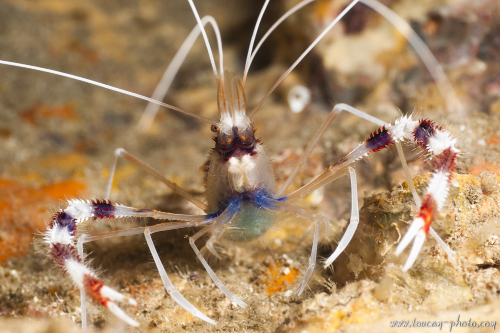
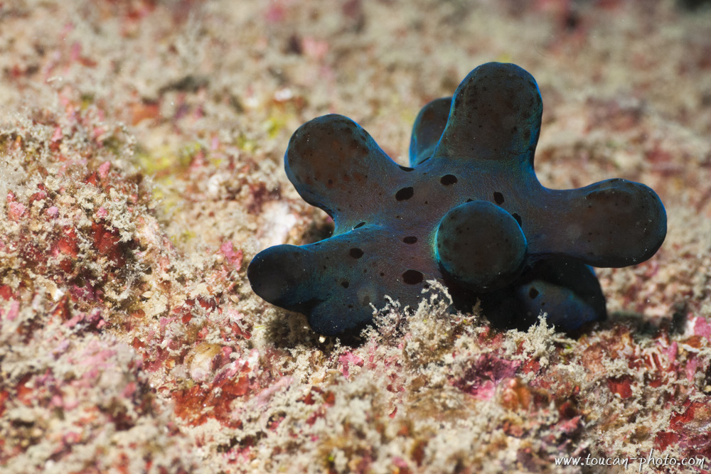
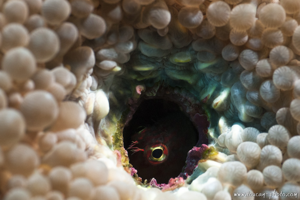
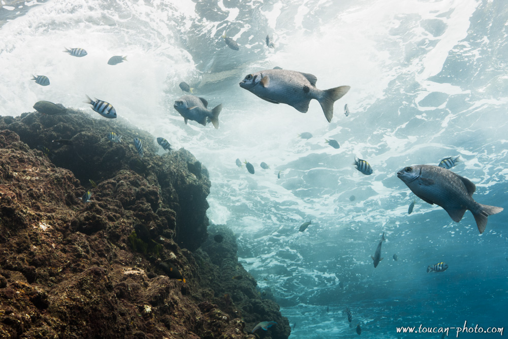
Thailand: Diving Andaman sea
The experts may certainly recognize Moray, Manta Ray, Clown fish, Parrotfish, Squid and Cuttlefish, different species of hard and soft corals, and some Shellfishes.
Have a good dive!
Andaman Sea location
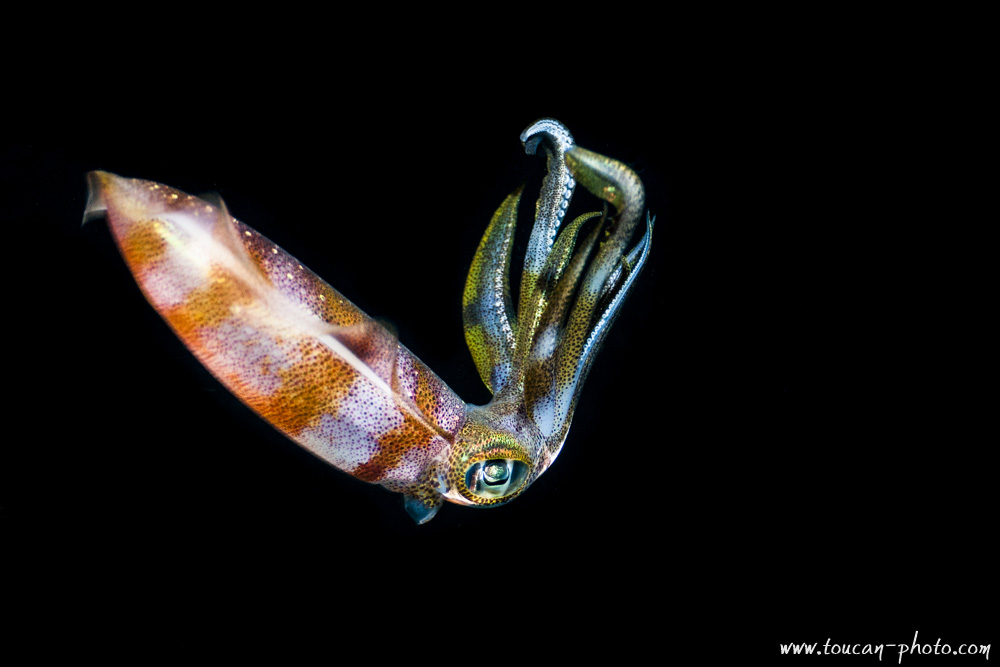 Night shot of a squid
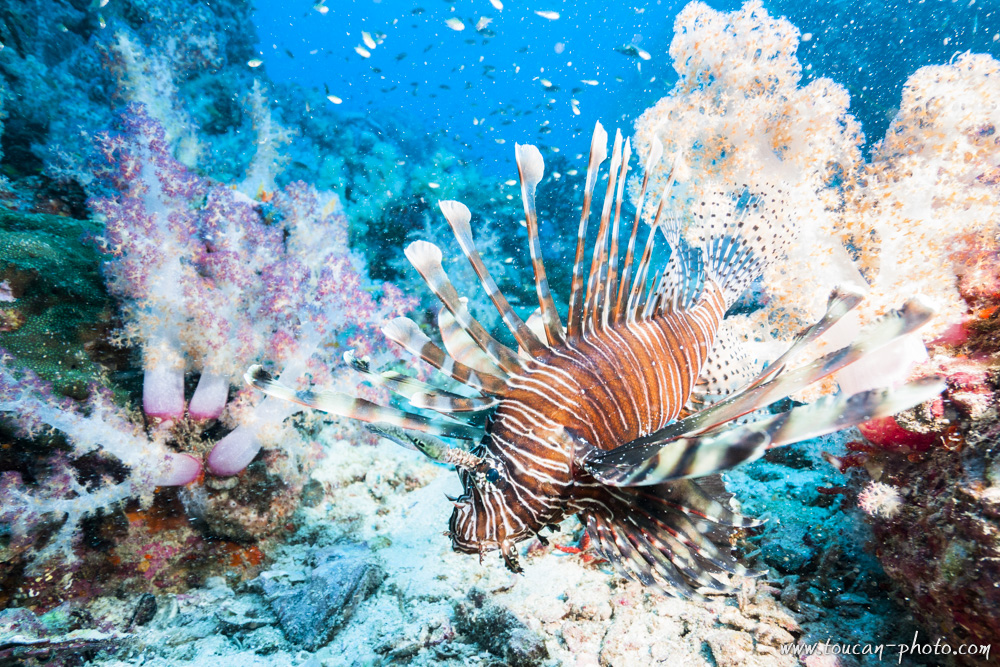 Lion Fish
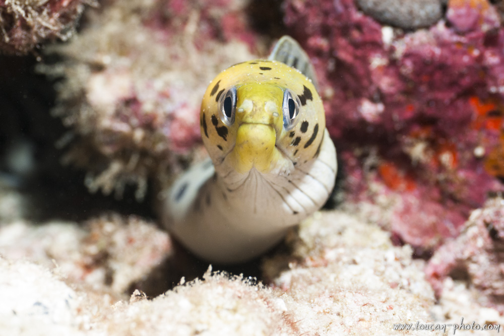 Yellow head moray
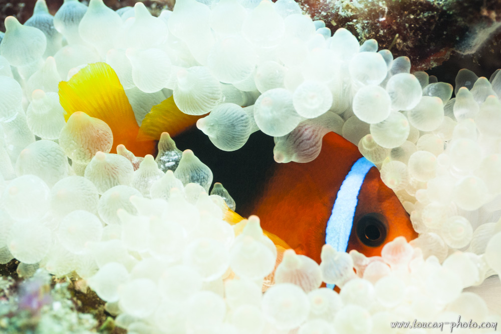
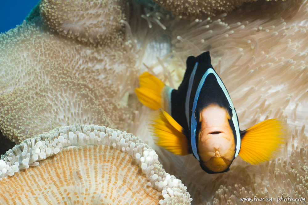 Clark’s anemone fish
 Banded cleaner shrimp (Stenopus hispidus)
 Hiby’s coriocella (Coriocella hibyae)
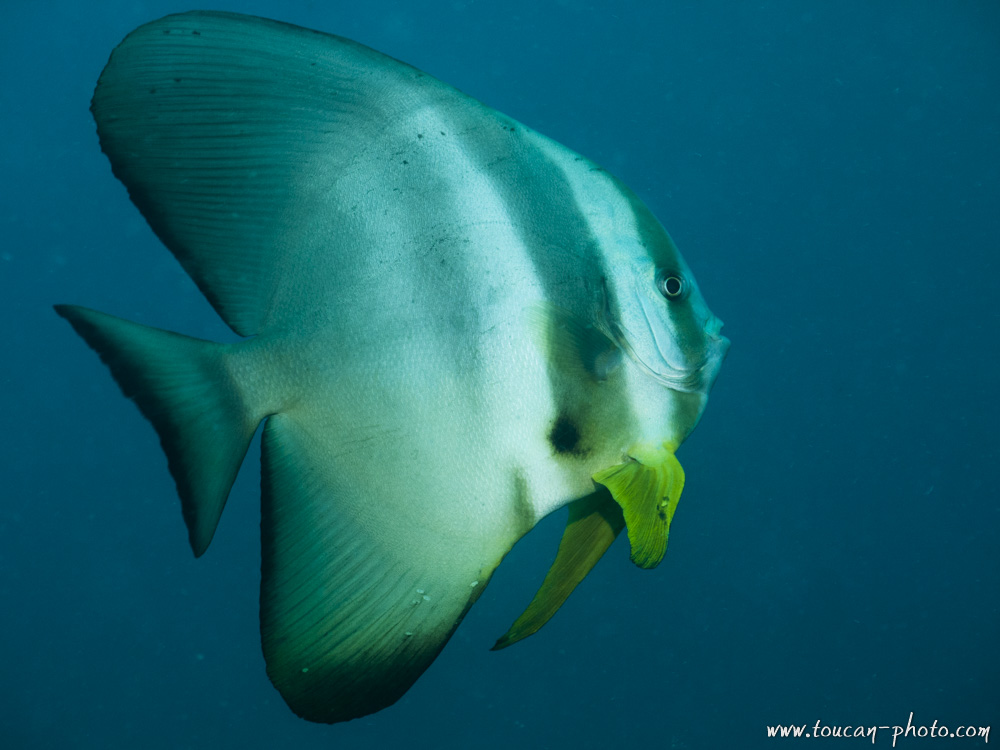 Batfish
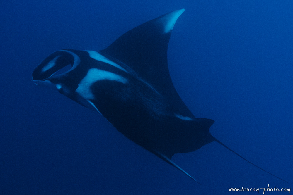
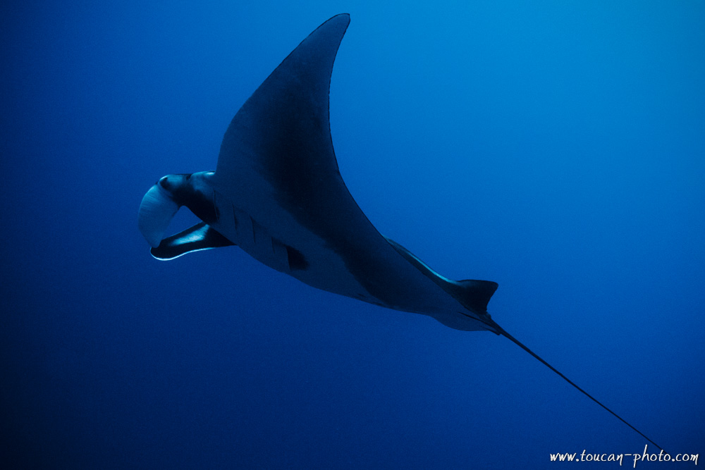 Manta ray
 A blenny try to get hide inside a coral hole
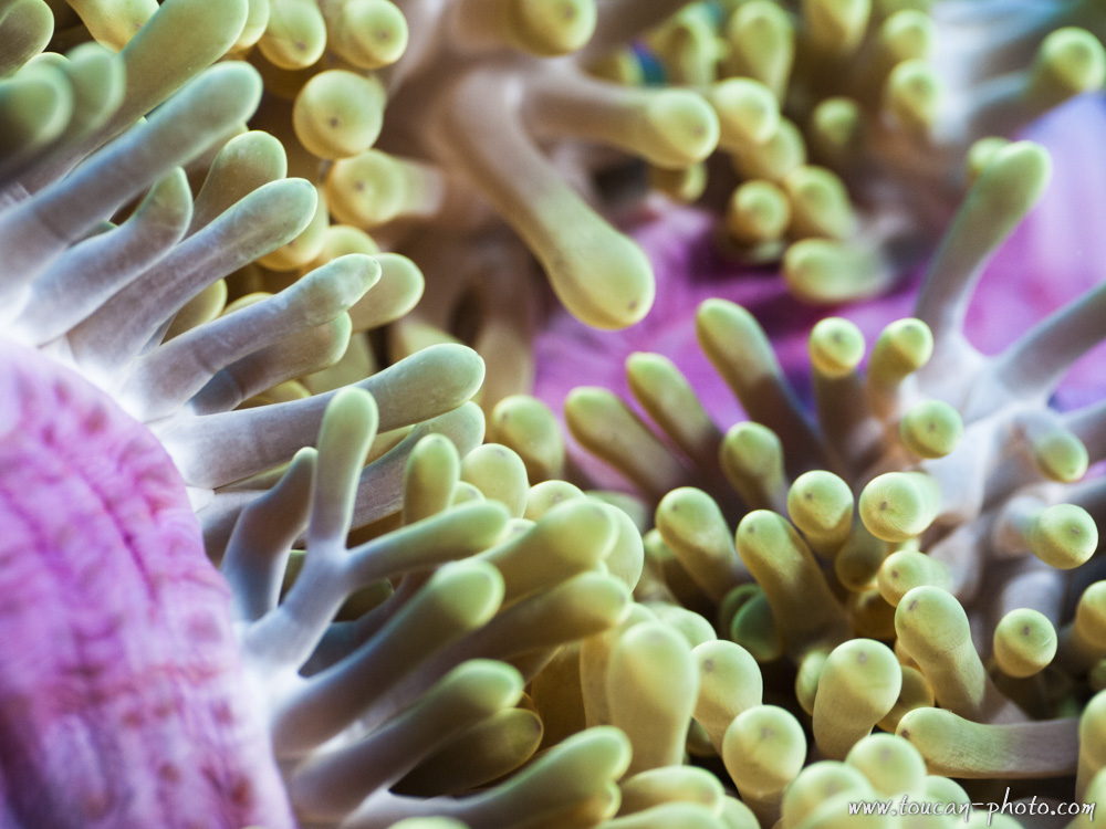 Inside the anemone
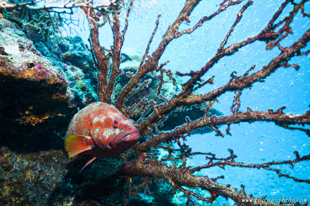 Coral hind (Cephalopholis miniata)
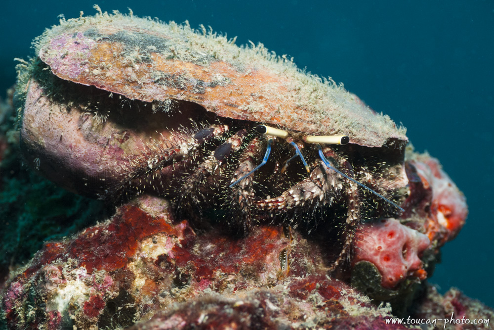 Hermit crab
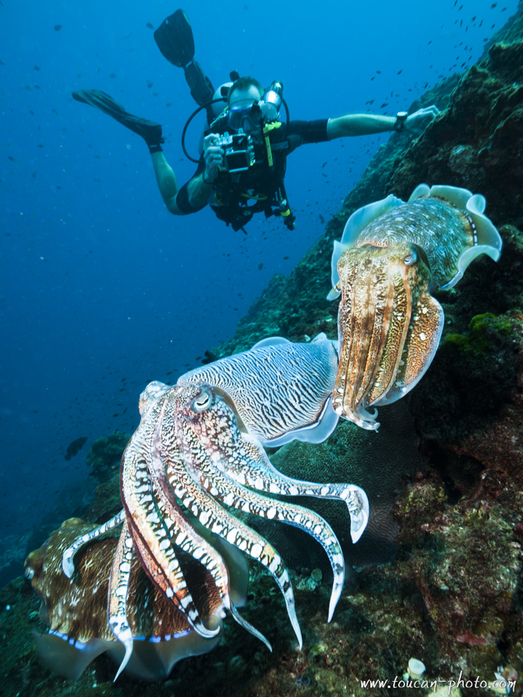 Cuttlefishes and diver
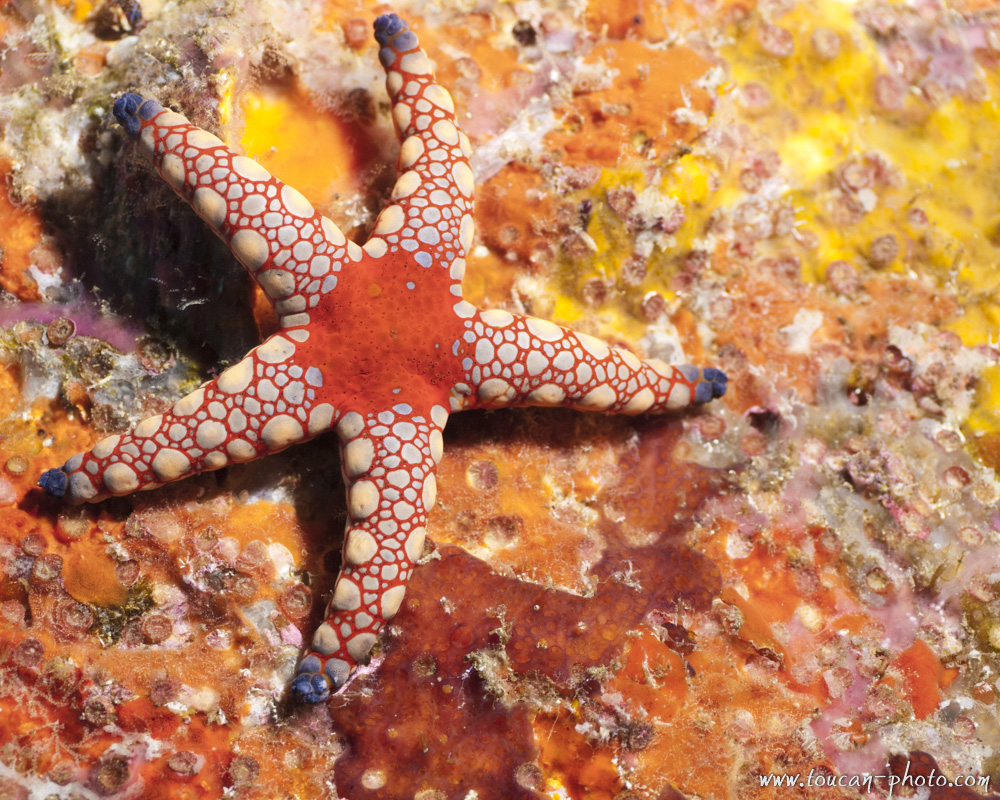 Sea star
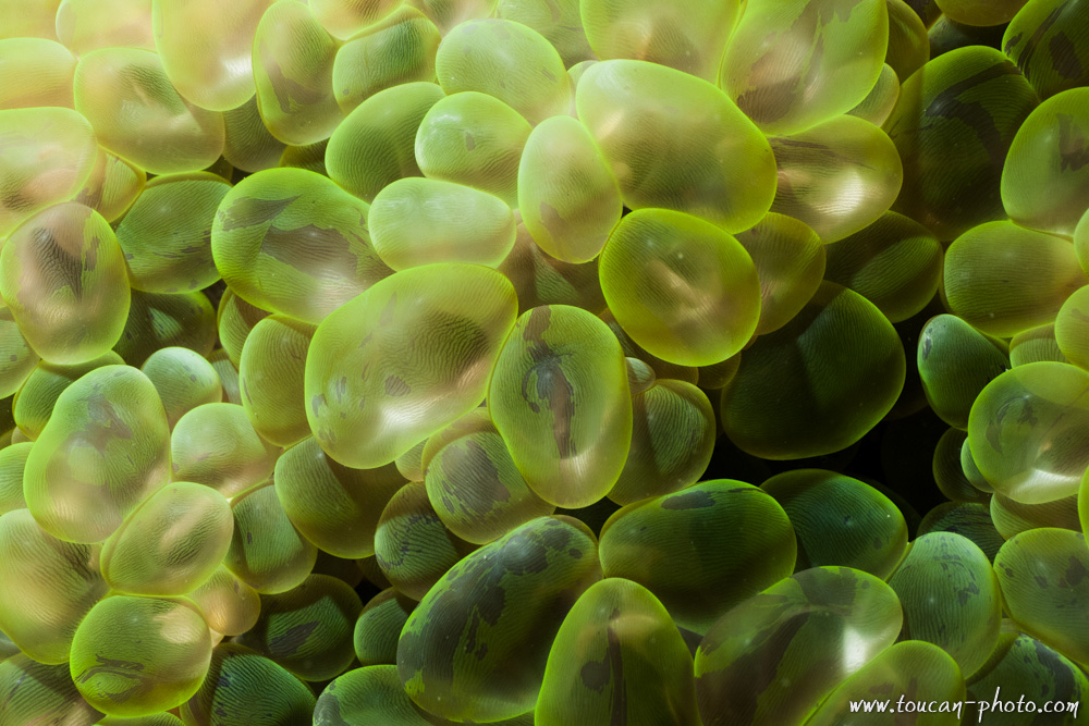 Bubble coral
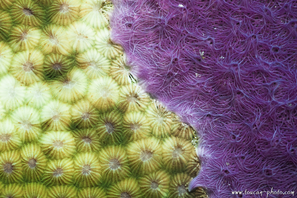 Coral
Coral
 Anemone-Fish in its anemone nest
 Manta Ray
 Reef
Reef
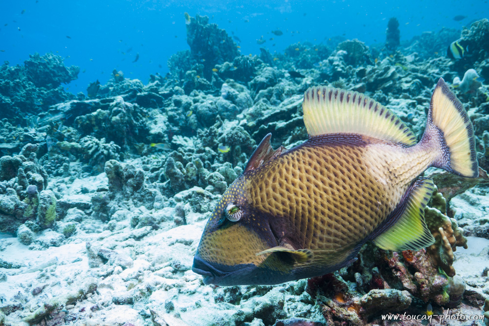 Trigger-Fish
Portugal: Azores, Sao Miguel waters
Everyone has heard of the Azores … At least during a weather report. 😉
AIndeed, an anticyclone is covering the Azores. It acts like a barrier and prevents precipitation to come to West Europe.
However, this is synonymous of heavy rains and strong winds to the Azorean population.
It took me a few minutes after getting out of the plane to realize that water is omnipresent in the Azores.
Rain, coulees, Hot springs getting out from nowhere, torrents, waterfalls … all in a small island in the middle of the Atlantic Ocean!
You see for yourself on the pictures that I have created, that water is everywhere !
Take a poncho!
Continue reading“Portugal: Azores, Sao Miguel waters”
Nepal: The Langtang National Park
Langtang is a region in the Himalayas of Nepal to the north of the Kathmandu Valley and bordering Tibet.
The Langtang National Park is located in the area. About 4,500 people live inside the park, and many more depend on it for timber and firewood. The majority of the residents are Tamang.
The park contains a wide variety of climatic zones, from subtropical to alpine. Approximately 25% of the park is forested. Trees include the deciduous Oak and Maple, and evergreens like Pine, and various types of Rhododendron.
Continue reading“Nepal: The Langtang National Park”
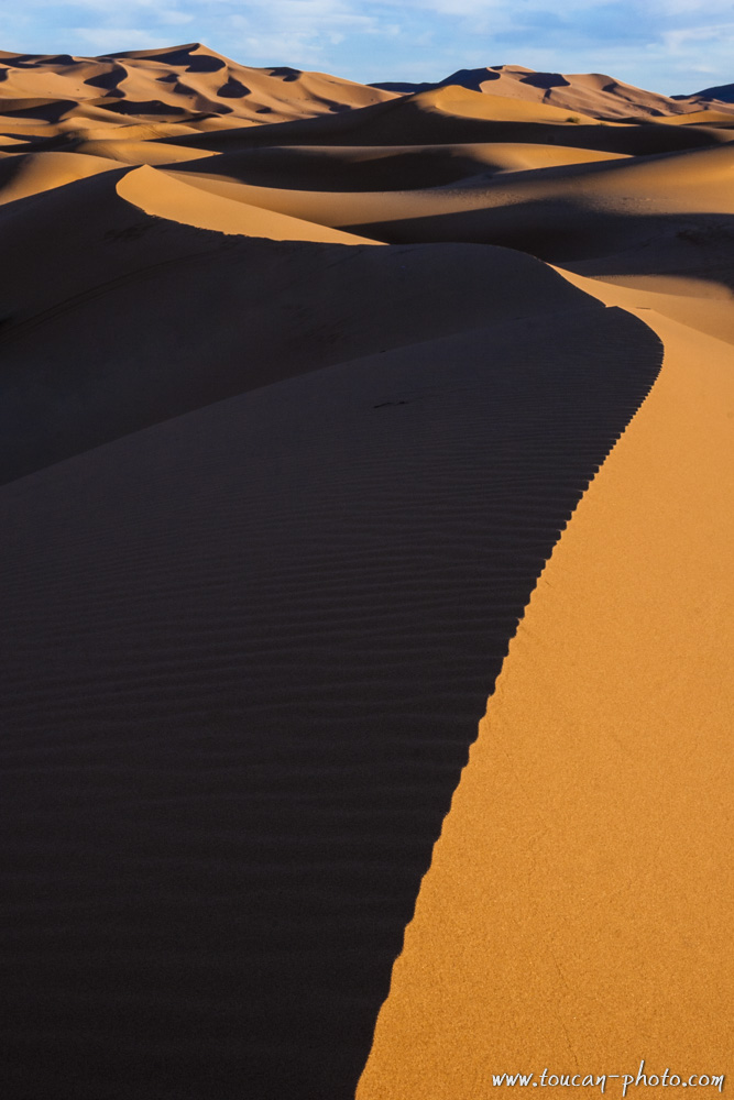
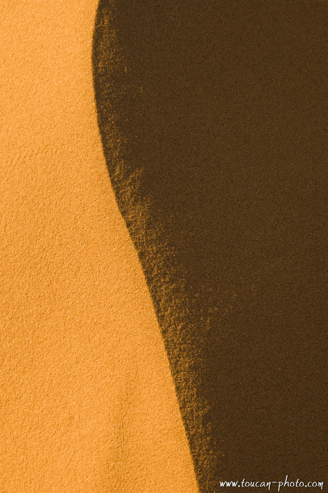
Morocco: Erg Chebbi, the Merzouga’s dunes
Erg Chebbi (Arabic: عرق الشبي) is one of Morocco’s two Saharan ergs – large seas of dunes formed by wind-blown sand.
This Erg is also knowed as “The Merzougas Dunes” beccause the proximity of Merzouga village.
The dunes of Erg Chebbi reach a height of up to 150 meters in places and altogether spans an area of 50 kilometers from north to south and up to 5–10 kilometers from east to west lining the Algerian border.
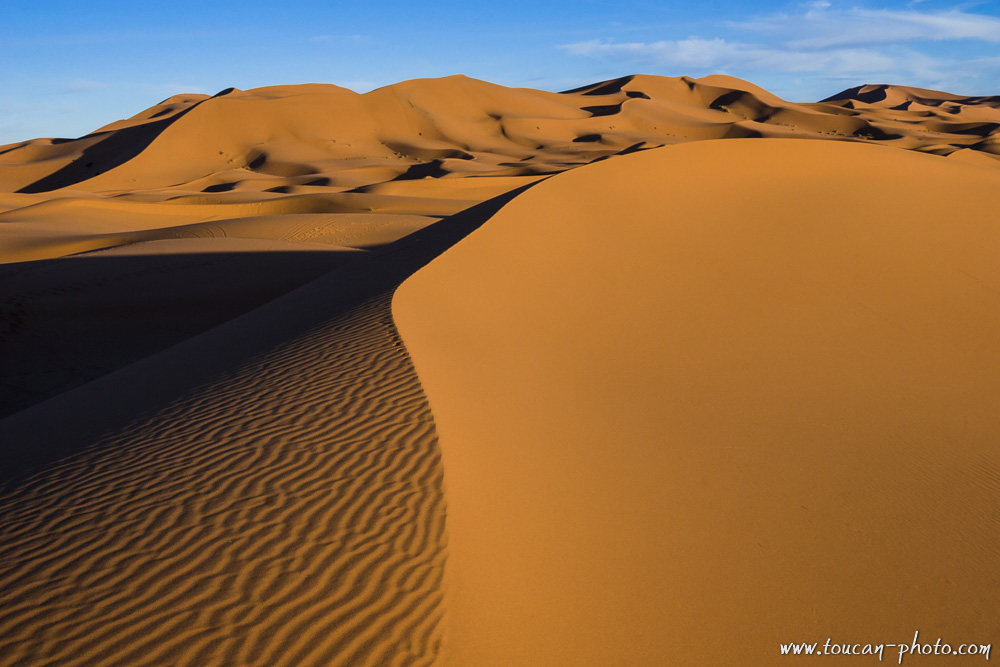 The Merzouga’s dunes
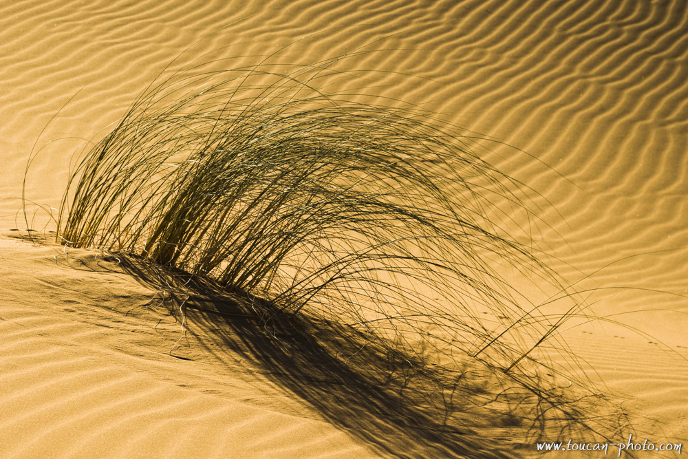 Vegetation
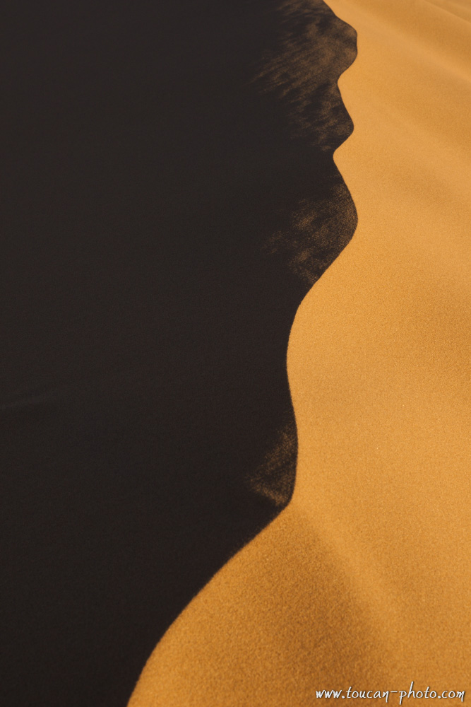 Detail
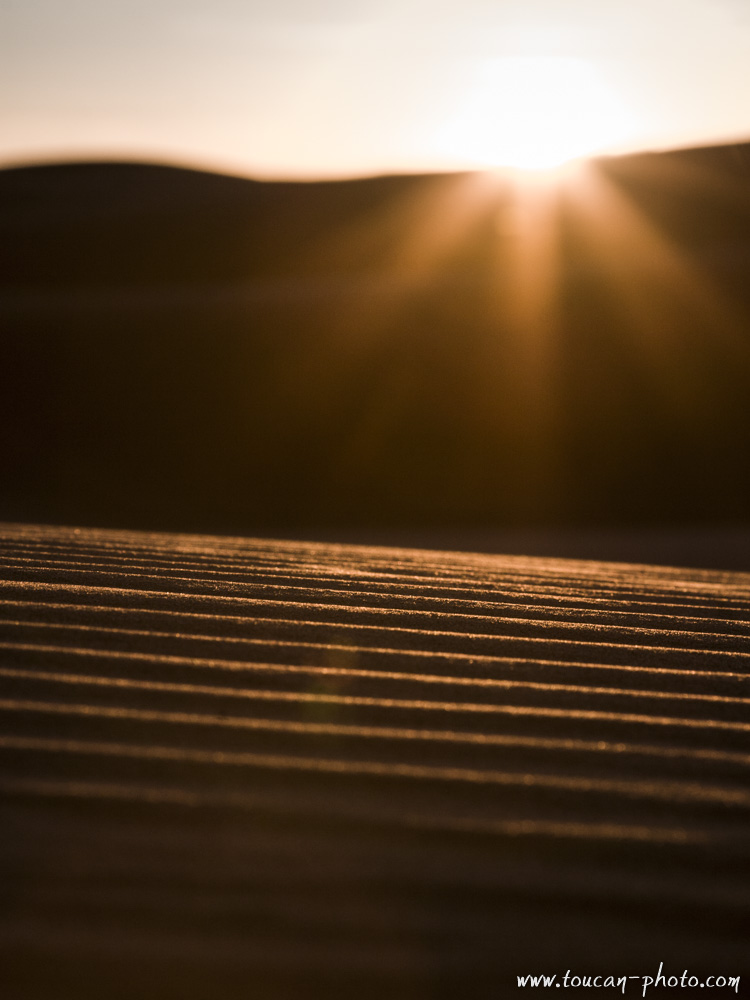 Sunset over the dunes
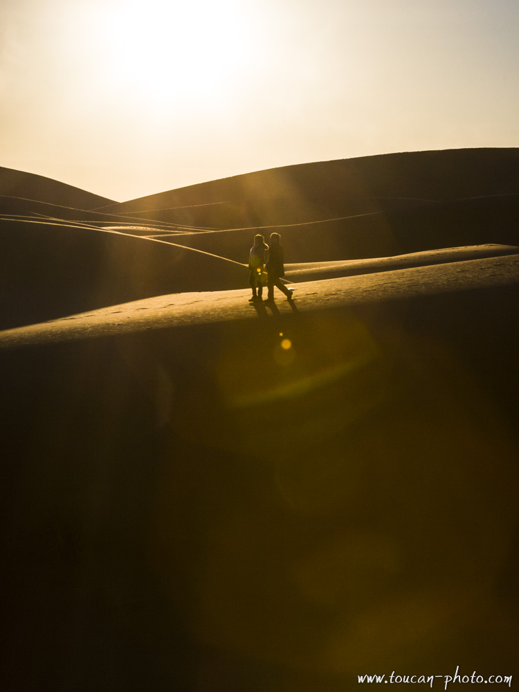 Walking the dunes
 Dunes
Dunes
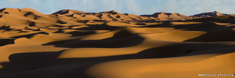 Panoramic view of the dunes
 Detail