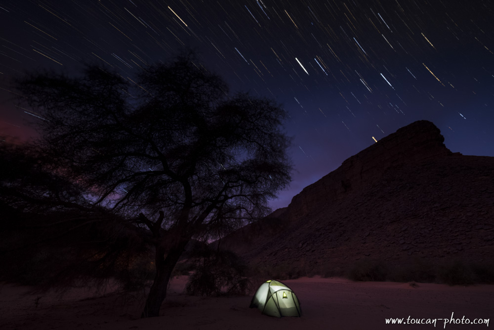
Overnight camp in the Sahara desert, Mauritania
Larger than Australia with its 8 million square kilometres, the Sahara has not always been the biggest hot desert on the planet. About 15,000 years ago, it was a green period brought about by a warming phase that had intensified evaporation from the top of the ocean and pushed the monsoons into the heart of the North African continent. The arid landscapes that we know today were then covered by large lakes and rich vegetation. Elephants were living there, as well as hippos, crocodiles and humans too. Those ones, as to immortalize this full of life period, have drawn paintings and engravings cut out of rock. These testimonies of the past are omnipresent in Tadrart Rouge. Indeed, this Sahara’s fragment is located in south-eastern Algeria and offers the vision of over 15,000 engravings to the brave who dare adventuring themselves into there. Over the sand dunes and rocky peaks, the traveller will discover, at the same time as breathtaking landscapes, a touching testimony of the past.
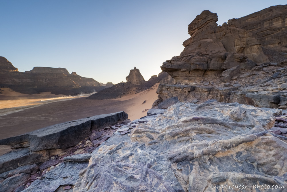
The Tadrart Rouge, located on the Algerian south-east part
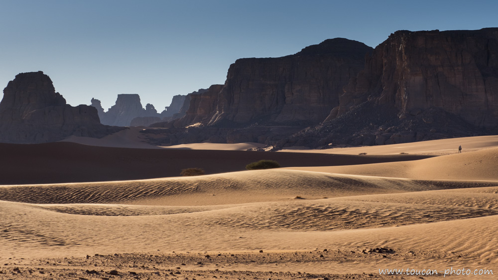
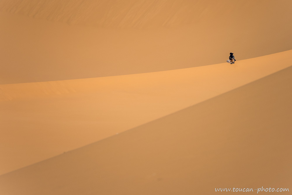
Sahara composition is about 20% of sandy surfaces and about 80% of rocky surfaces, mostly sedimentary rocks. The hiker on the right allows us to imagine the landscape scale.
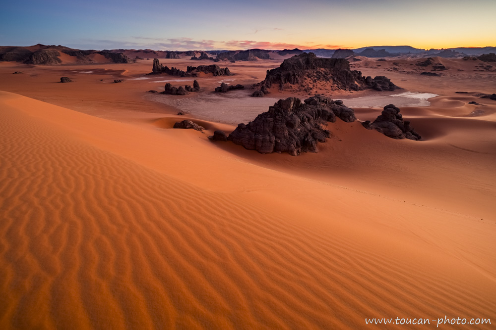
Tadrart Rouge overview
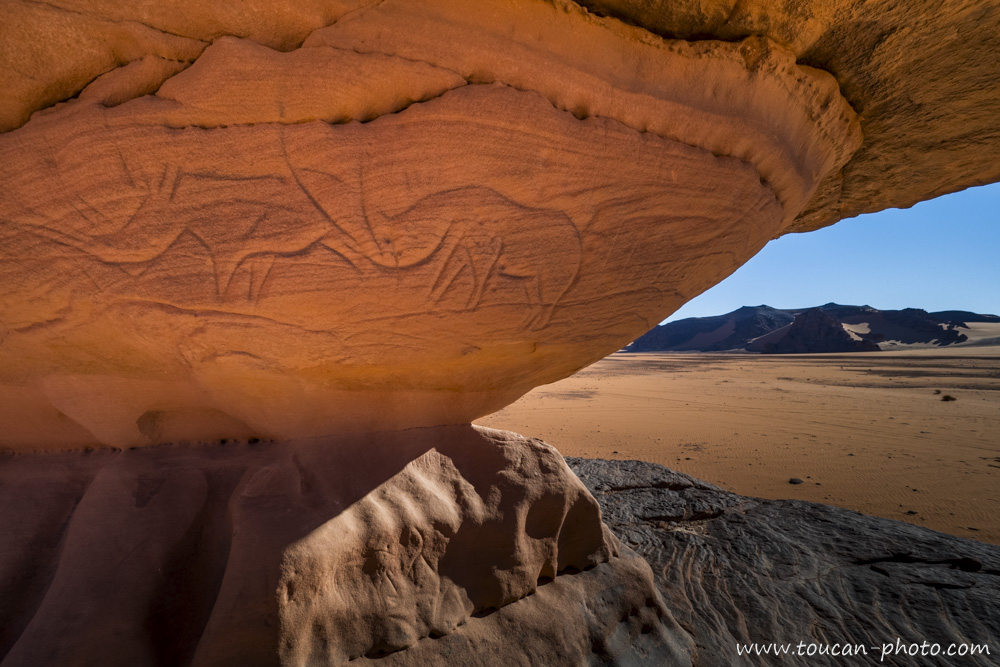
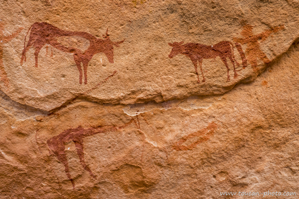
Here you can see one of the 15,000 engravings that can be discovered into the Tadrart Rouge. The oldest ones are estimated to be about 12,000 years old.
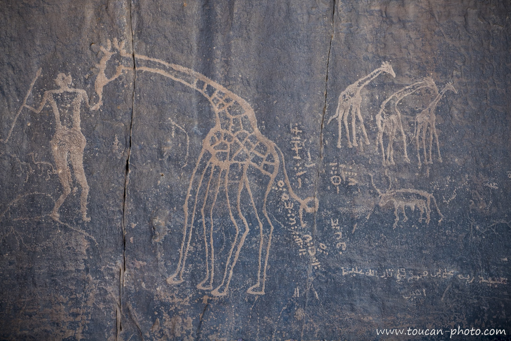
Another engraving, this time staging giraffes. The character on the left seems to be a hunter.
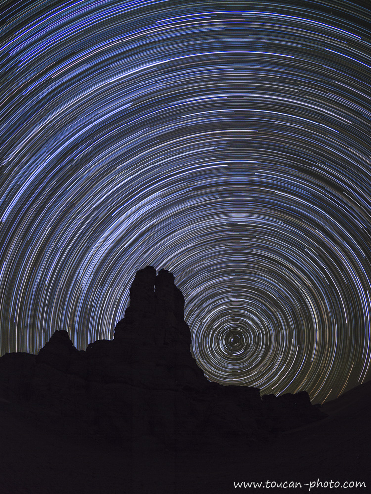
Night long exposure photography of “Moulnaga” peak, located in the heart of Tadrart Rouge. The 3 hours long exposure allowed the stars to trace these beautiful light full arabesques.
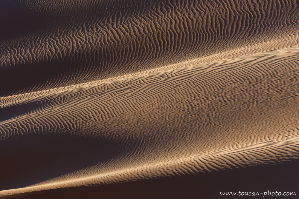
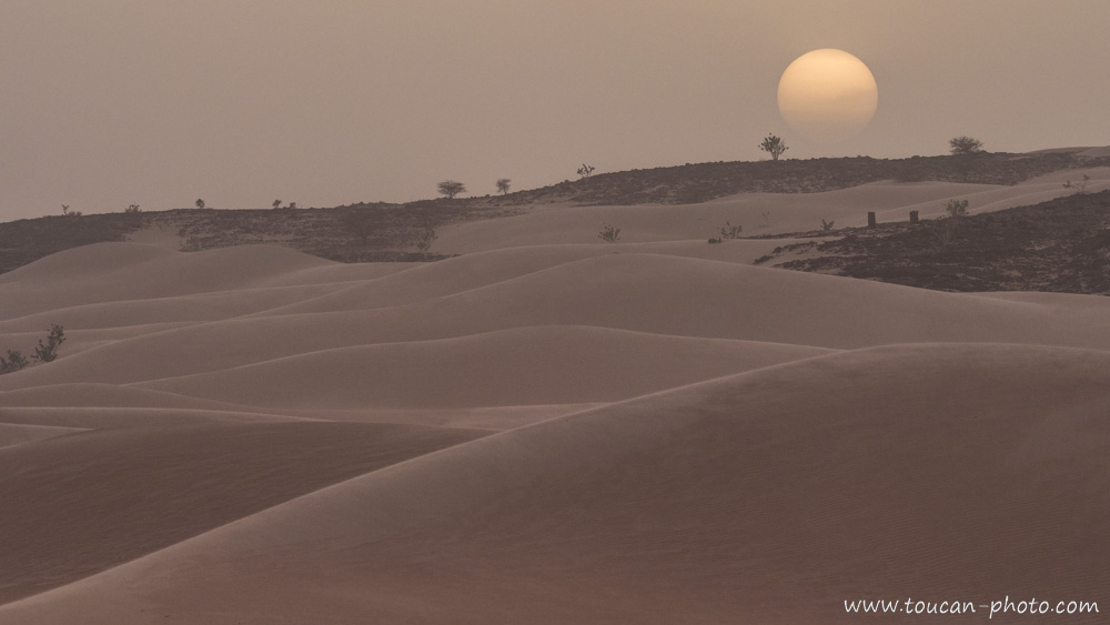
During the day, we can see another kind of arabesques: the ones drawn by the wind in the sand.
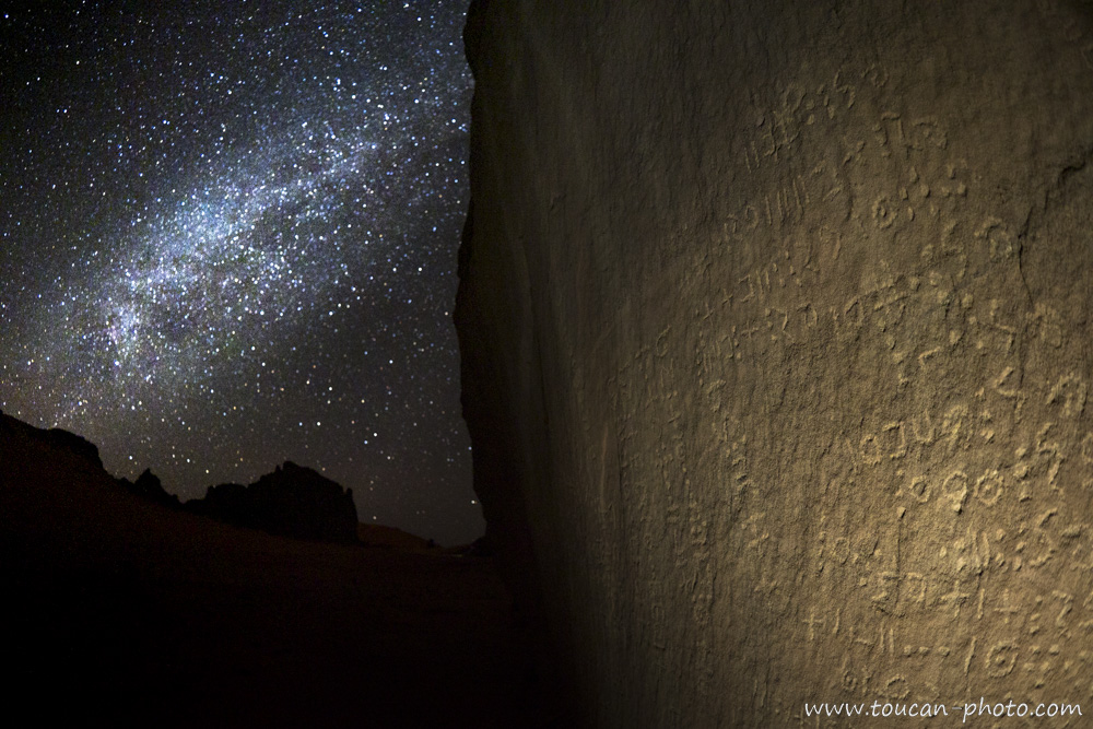
Tifinagh (“ⵜⴼⵏⵗ” or “ⵜⵉⴼⵉⵏⴰⵗ”) is a Berber alphabet existing for about 6,000 years. It can be found in many writings, like here on this rock photographed at night with the Milky Way as background.
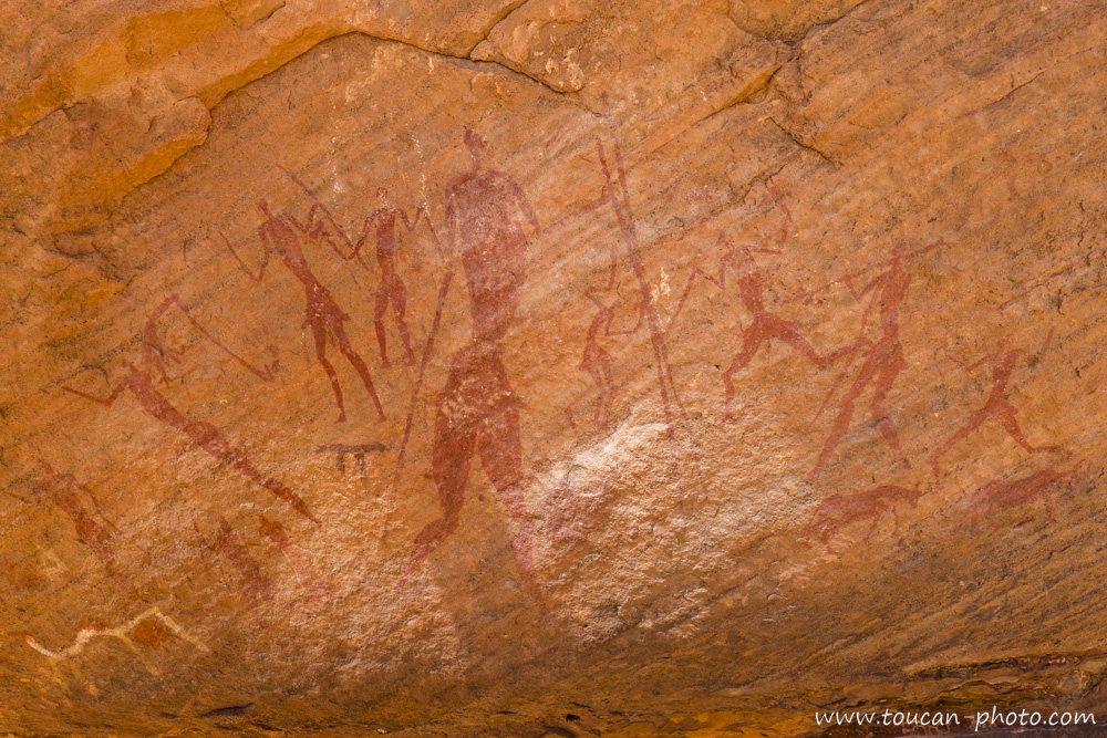
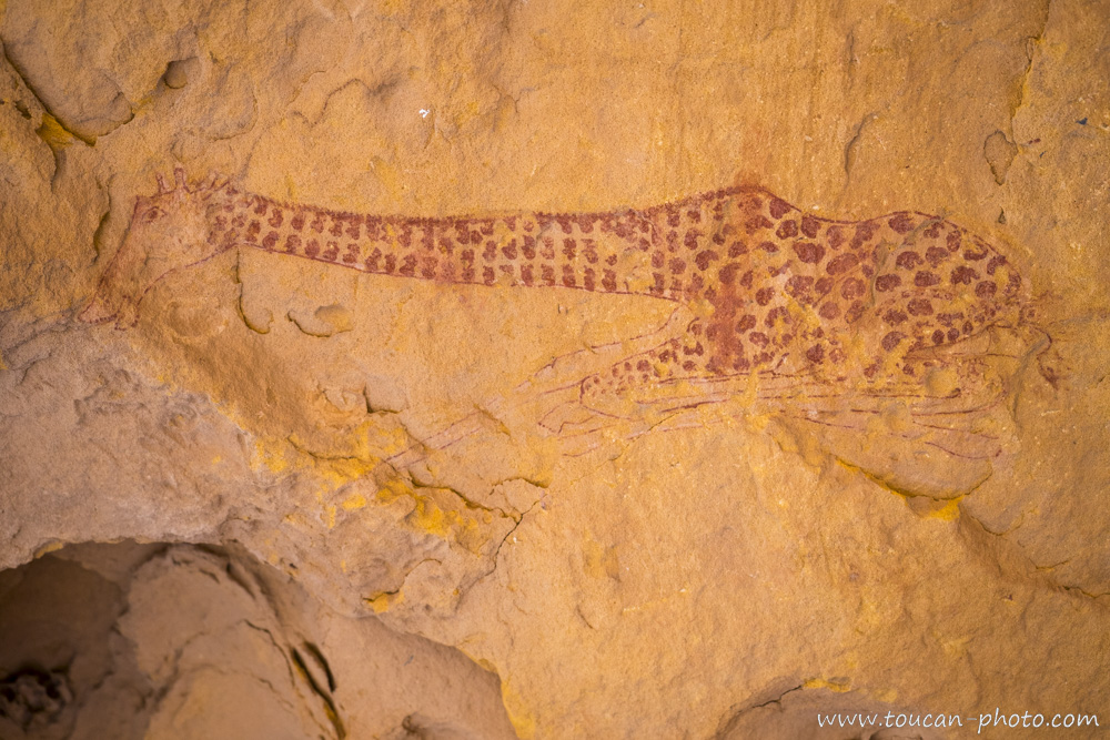
Additionally to the engravings, we can see many paintings directly on rock. Human characters are staging in what seems to be daily life representation: dances, songs, hunts, etc.
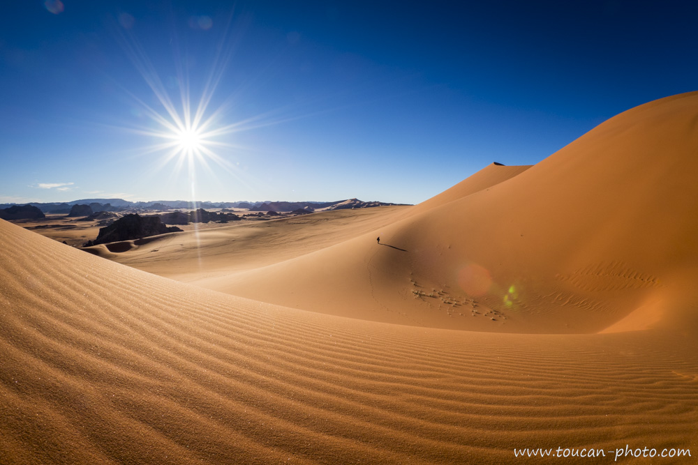
A lonely hiker in the desert.
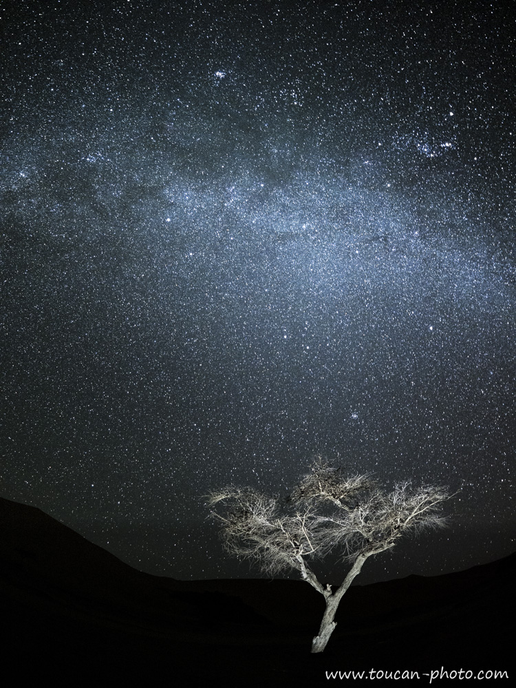
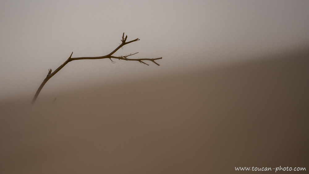
Milky Way photography with an Acacia forefront. Although its 15-meter deep roots make it very drought resistant, this tree remains quite rare in the Tadrart Rouge.
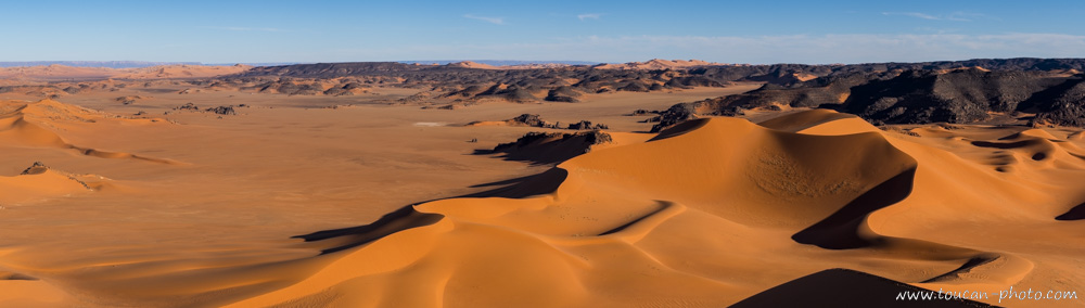
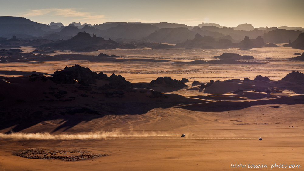
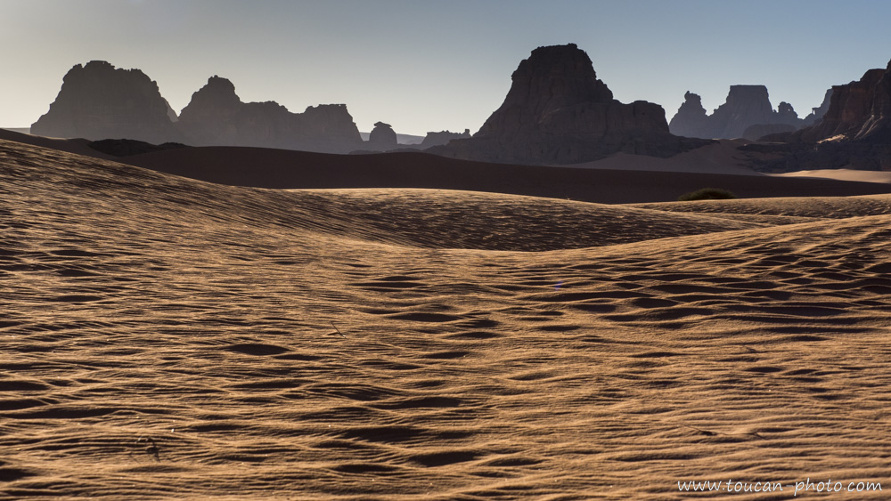
Tadrart Rouge vastness. Behind the dark rock barrier, the Tadrart Rouge extends to Libya, which can be seen in the background.
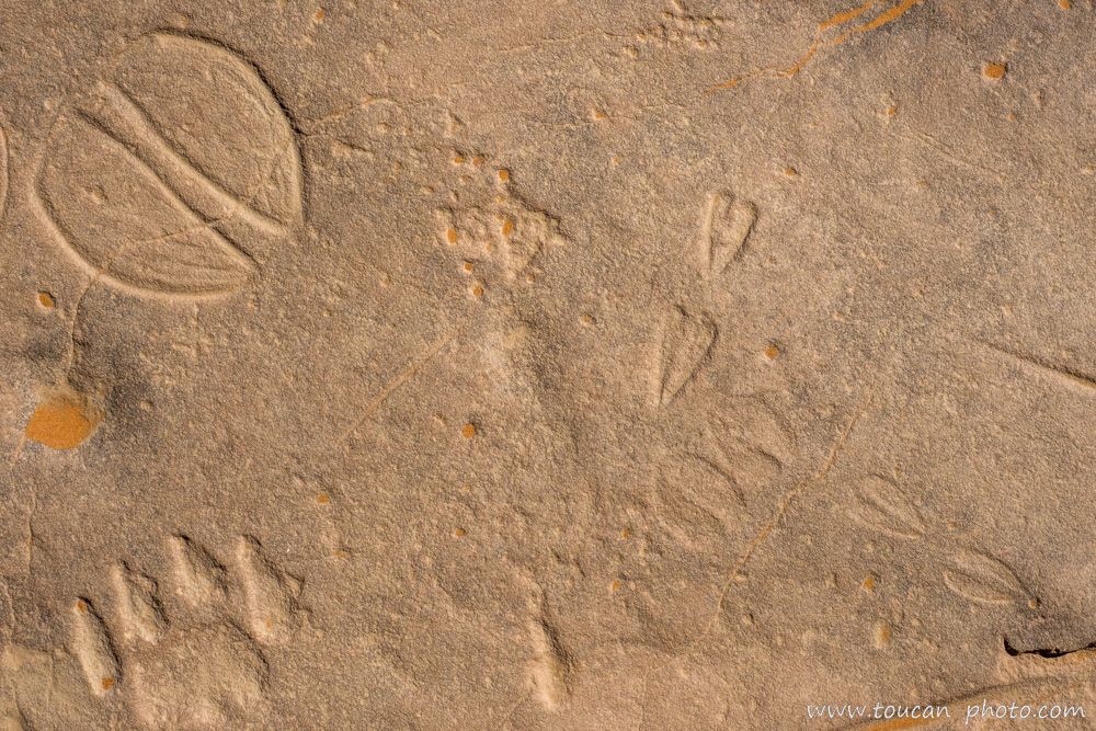
Engravings of animal footprints.
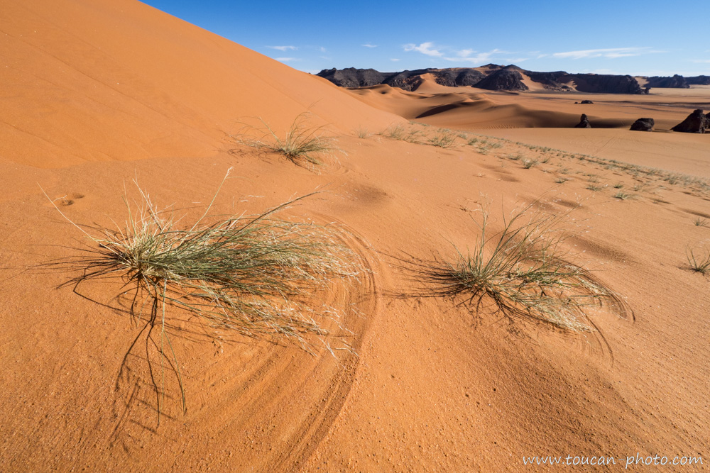
The wind models dunes and draws in the sand thanks to dry blades of grass.
While some can spend many hours admiring the pared down lines of the desert…
… Others choose to ride at full speed through Tadrart Rouge windings.
Those marine fossils remind us that, once, water was here in abundance. About 100 million years ago, the sea was covering part of the Sahara.
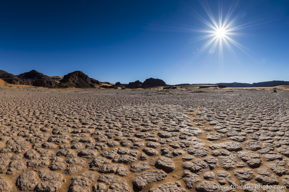
Burning sun over a dried up Guelta. The bowl form of the ground retains water during rare rainfalls, which then evaporates, letting this thin cracked clay crust.
Old rock paintings realized in a very pared down style.
More complex rock painting. Depending on the eras, different techniques and styles succeeded one another.
Sand and Rock
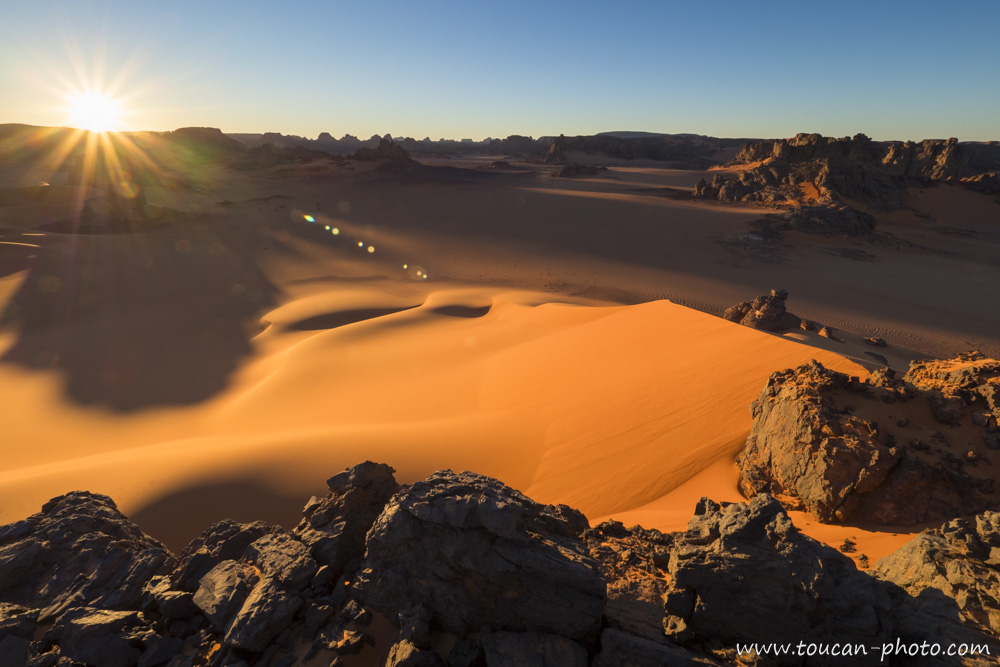
Tadrart Rouge’s sunset
— Continue the journey —
All the pictures from the Sahara desert
— Complementary Resources —
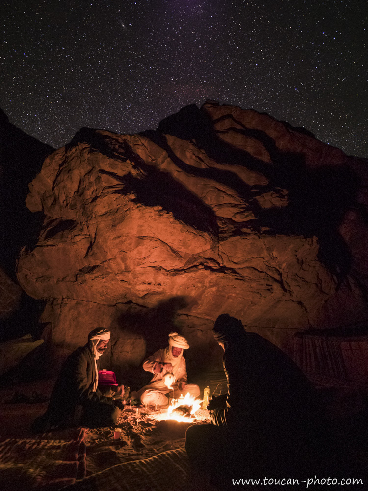
Tea time for the Touaregs of the algerian sahara desert
The preparation of tea is a ritual of extreme refinement among the Tuaregs. Using the same leaves, three consecutive tea are prepared. The flavors of each tea evolve infusion after infusion.
A Tuareg saying says: “The first is bitter like life; the second is sweet like love; and the third is gentle like the breath of death.”.
Read the paper about the Tadrart Rouge, a window to the Sahara and its history
Erg Chebbi (Arabic: عرق الشبي) is one of Morocco’s two Saharan ergs – large seas of dunes formed by wind-blown sand.
This Erg is also knowed as “The Merzougas Dunes” beccause the proximity of Merzouga village.
The dunes of Erg Chebbi reach a height of up to 150 meters in places and altogether spans an area of 50 kilometers from north to south and up to 5–10 kilometers from east to west lining the Algerian border.
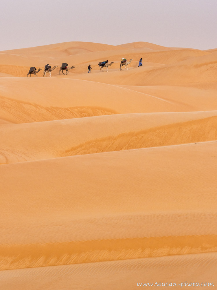
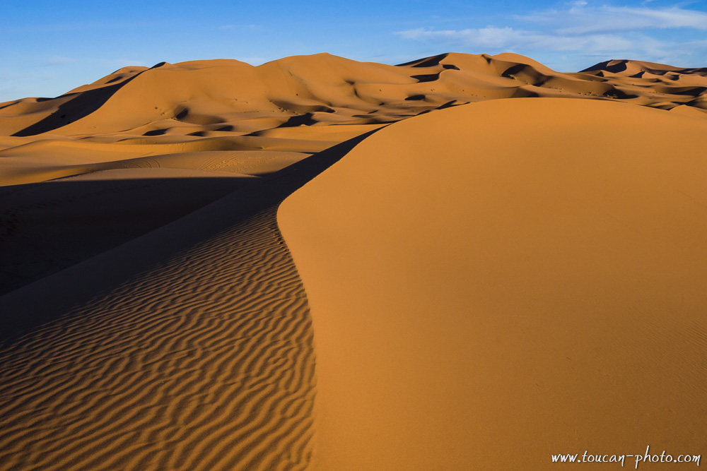 The Merzouga’s dunes
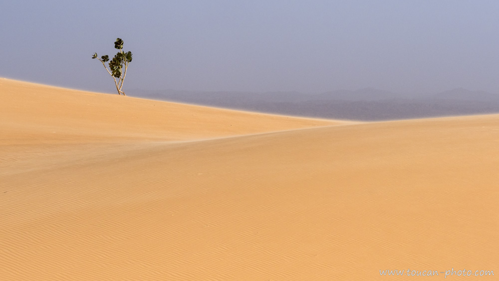
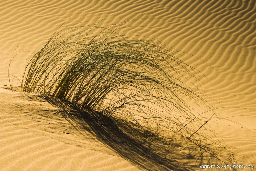 Vegetation
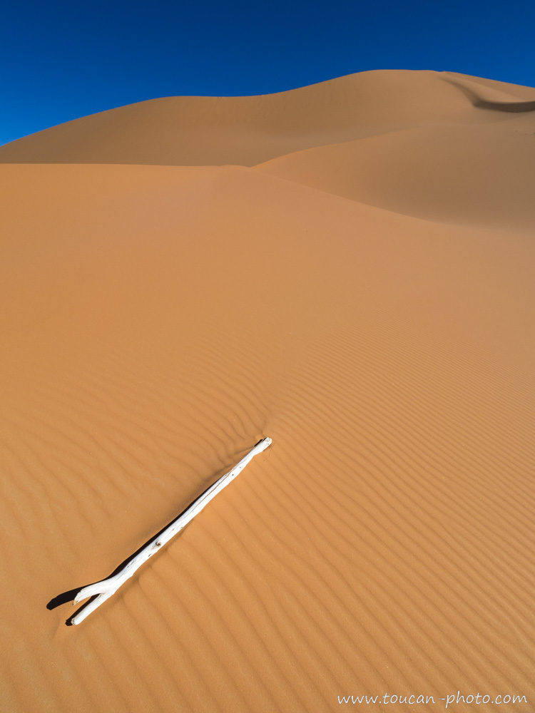
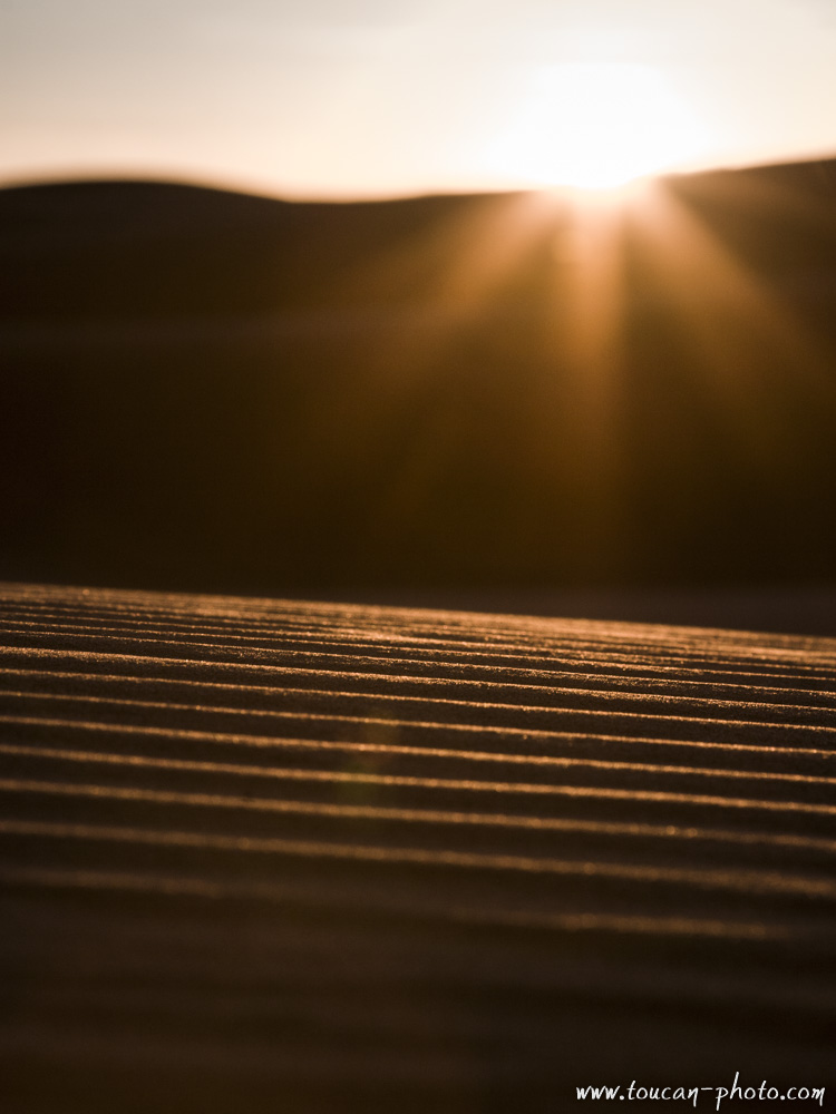
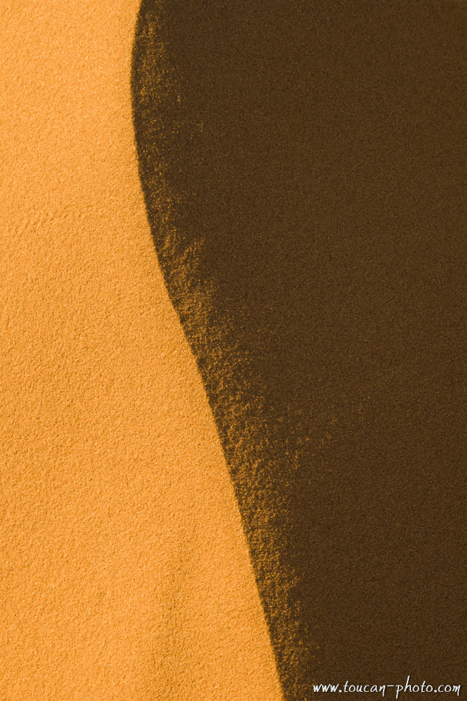
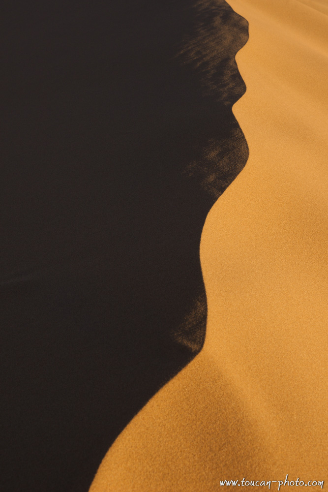 Detail
 Sunset over the dunes
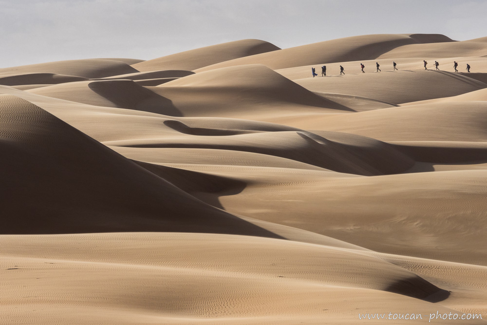
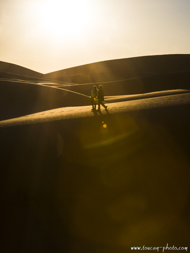 Walking the dunes
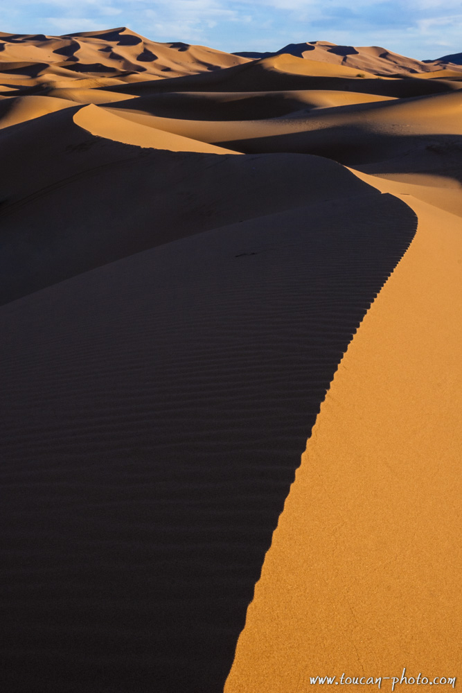 Dunes
Dunes
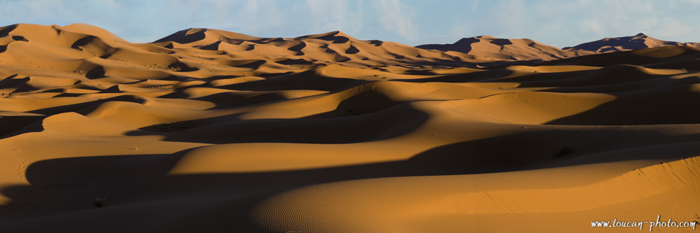 Panoramic view of the dunes
 Detail